|
search place name
|
||
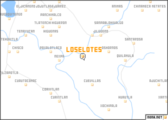
Los Elotes (Morelos, Mexico)Los Elotes is a town in the Morelos region of Mexico. An overview map of the region around Los Elotes is displayed below.
regional and 3d topo map of Los Elotes, Mexico ::
Los Elotes airports ::
The nearest airport is CVJ - Cuernavaca General Mariano Matamoros, located 38.4 km north west of Los Elotes.
Other airports nearby include MEX - Mexico City Licenciado Benito Juarez Intl (101.9 km north), TLC - Toluca Licenciado Adolfo Lopez Mateos Intl (102.4 km north west), PBC - Puebla Hermanos Serdan Intl (105.9 km north east), TXA - Tlaxcala (150.5 km north east), Nearby towns ::
Nexpa (5.3km west) //
Los Hornos (5.6km east) //
Chimalacatlán (5.8km south) //
Cuevillas (5.8km south) //
Astillero (5.8km north) //
Jilguero (6.6km north east) //
Paxalotlaco (7.3km west) //
Higuerón (9.1km north west) //
San Pablo Hidalgo (9.1km north east) //
Higueras (9.0km north west) //
Coaxitlan (10.2km south west) //
[all distances 'as the bird flies' and approximate] 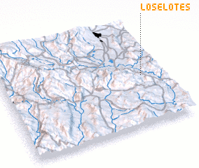 Places with similar names to Los Elotes, Mexico ::
// Los Altos (BZ)
// Los Altos (US)
// Los Altos (US)
// Los Lotes (PA)
// Las Celadas (ES)
// Las Ledas (ES)
// Las Saladas (ES)
// Los Lodos (ES)
// Las Olitas (CO)
// Los Altos (CO)
Disclaimer :: Information on this page comes without warranty of any kind |
||
|
Where is Los Elotes? Elevation and coordinates ::
Latitude (lat): 18°31'0"N Longitude (lon): 99°7'0"W
Elevation (approx.): 871m (map arrows pan, magnifying glasses zoom) |
||
|
Visiting Los Elotes? Hotel/Accommodation ::
Book a hotel in Los Elotes Travel Guide ::
Buy a travel guide for Mexico rental cars ::
car rental offers GPS waypoint ::
download a GPX waypoint (PoI) of Los Elotes for your GPS receiver
|
||