|
search place name
|
||
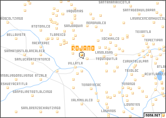
Rojano (Tlaxcala, Mexico)Rojano is a town in the Tlaxcala region of Mexico. An overview map of the region around Rojano is displayed below.
regional and 3d topo map of Rojano, Mexico ::
Rojano airports ::
The nearest airport is PBC - Puebla Hermanos Serdan Intl, located 16.7 km south of Rojano.
Other airports nearby include TXA - Tlaxcala (33.5 km north east), MEX - Mexico City Licenciado Benito Juarez Intl (74.0 km west), PCA - Pachuca Ingeniero Juan Guillermo Villasana (95.0 km north west), CVJ - Cuernavaca General Mariano Matamoros (106.5 km south west), Nearby towns ::
San Diego Xocoyucan (0.9km east) //
Popocatla (1.0km north) //
El Monte de los Olivos (1.9km north) //
Villatla (2.5km south west) //
La Corona (2.5km north west) //
Tepetitla (2.8km south) //
San Felipe Ixtacuixtla (3.1km north east) //
San Mateo Ayecac (3.4km south) //
La Ladera (3.8km north west) //
Santa Cruz del Porvenir (4.4km north east) //
La Soledad (4.6km east) //
San Baltasar Temaxcalac (5.1km south west) //
Guadalupe (5.1km north west) //
El Ocotal (5.1km north west) //
Nopalucan (5.0km east) //
Tequixquitla (5.0km east) //
San José Capula (5.3km north east) //
San Miguel La Presa (5.5km north) //
El Nopalillo (5.4km north west) //
Tizostoc (5.5km north east) //
Santa Inés Tecuexcomac (5.7km south east) //
San Nicolás (5.8km north west) //
Espíritu Santo (5.8km north west) //
Tecoac (6.0km north east) //
San Martín Texmelucan de Labastida (6.2km south west) //
Santa María Moyotzingo (6.8km south) //
San Joaquín (6.8km north) //
Tenanyecac (7.0km south) //
Xochimilco (6.9km north east) //
[all distances 'as the bird flies' and approximate]  Places with similar names to Rojano, Mexico ::
Disclaimer :: Information on this page comes without warranty of any kind |
||
|
Where is Rojano? Elevation and coordinates ::
Latitude (lat): 19°18'30"N Longitude (lon): 98°22'50"W
Elevation (approx.): 2229m (map arrows pan, magnifying glasses zoom) |
||
|
Visiting Rojano? Hotel/Accommodation ::
Book a hotel in Rojano Travel Guide ::
Buy a travel guide for Mexico rental cars ::
car rental offers GPS waypoint ::
download a GPX waypoint (PoI) of Rojano for your GPS receiver
|
||