|
search place name
|
||
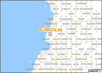
Al Manzilah (Mont-Liban, Lebanon)Al Manzilah is a town in the Mont-Liban region of Lebanon. An overview map of the region around Al Manzilah is displayed below.
regional and 3d topo map of Al Manzilah, Lebanon ::
Al Manzilah airports ::
The nearest airport is BEY - Beirut Rafic Hariri Intl, located 27.9 km south west of Al Manzilah.
Other airports nearby include DAM - Damascus Intl (105.8 km south east), RPN - Rosh Pina Mahanaim I Ben Yaakov (116.9 km south), HFA - Haifa (147.0 km south west), LTK - Latakia Bassel Al Assad Intl (154.2 km north), Nearby towns ::
Kafr Ḩbāb (1.9km south) //
Admā (1.9km south) //
Bqāq ad Dīn (1.9km north) //
Ash Shi‘b (1.9km north) //
Ḩayy al Qiddīsah Ḩannah (1.9km north) //
Kafr Shaḩḩām (1.9km north) //
Al Khirbah (1.9km north) //
Sīrān Dāwūd (1.5km west) //
Ḩayy Ḑahr al Balāţah (1.5km east) //
Ţabarjā (1.5km west) //
Aş Şafrāʼ (1.5km west) //
Wādī Tālī (1.5km east) //
Al Bayādir (1.5km east) //
Ḑahr al Ḩimār (1.5km west) //
‘Ayn aş Şughayrah (1.5km west) //
Ad Daqārīn (1.5km west) //
Fatqā (1.5km east) //
Admā ad Dafnah (1.5km west) //
Ḩayy Mār Şūfiyā (1.5km west) //
Qurqārah (1.5km east) //
Ḑahr al Midaqqah (1.5km west) //
Aḑ Ḑahr (1.5km west) //
Waţāʼ Sillām (2.4km south west) //
Az Zu‘aytirīyah (2.4km south east) //
Ḩayy Qalb Yasū‘ (2.4km south east) //
Ar Rāmiyah (2.4km south west) //
Ḩayy Mār Ilyās (2.4km south east) //
An Nā‘ūrah (2.4km south west) //
Ghazīr (2.4km south east) //
[all distances 'as the bird flies' and approximate]  Places with similar names to Al Manzilah, Lebanon ::
// Almancil (PT)
// Al Manzalah (EG)
// Al Manzilah (EG)
// Al Munayzilah (SY)
// Almensilla (ES)
// Al Manāzīl (LB)
// Al Manāzīl (LB)
// Al Manzilah (LB)
// Al Manzilah (LB)
// Al Manzilah (LB)
Disclaimer :: Information on this page comes without warranty of any kind |
||
|
Where is Al Manzilah? Elevation and coordinates ::
Latitude (lat): 34°2'0"N Longitude (lon): 35°39'0"E
Elevation (approx.): 391m (map arrows pan, magnifying glasses zoom) |
||
|
Visiting Al Manzilah? Hotel/Accommodation ::
Book a hotel in Al Manzilah Travel Guide ::
Buy a travel guide for Lebanon rental cars ::
car rental offers GPS waypoint ::
download a GPX waypoint (PoI) of Al Manzilah for your GPS receiver
|
||