|
search place name
|
||
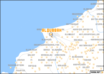
Al Qubbah (Liban-Nord, Lebanon)Al Qubbah is a town in the Liban-Nord region of Lebanon. An overview map of the region around Al Qubbah is displayed below.
regional and 3d topo map of Al Qubbah, Lebanon ::
Al Qubbah airports ::
The nearest airport is BEY - Beirut Rafic Hariri Intl, located 75.7 km south west of Al Qubbah.
Other airports nearby include LTK - Latakia Bassel Al Assad Intl (107.7 km north), DAM - Damascus Intl (129.0 km south east), RPN - Rosh Pina Mahanaim I Ben Yaakov (163.1 km south), HFA - Haifa (195.1 km south west), Nearby towns ::
Trâblous (0.0km north) //
Ad Dabbāghah (0.0km north) //
Ḩārat ash Sharafah (1.9km south) //
At Tarbī‘ah (1.5km west) //
Al Mallūlah (1.9km north) //
Khannāq Ḩimārah (1.5km west) //
Al Baḩşāş (2.4km south west) //
Tallat Mīshāl (2.4km south west) //
Majdalayyā (2.4km south east) //
Al Madīnah al Jadīdah (2.4km north east) //
Al Baddāwī (2.4km north east) //
Wādī an Naḩlah (2.4km north east) //
Hâret ej Jdîdé (3.3km south east) //
Al Fawwār (3.1km east) //
Ḑahr al ‘Ayn (3.7km south) //
El Mîna (3.6km north west) //
Raʼs Masqá ash Shamālīyah (4.0km south) //
Ḩaşrūn al Jadīdah (4.0km south) //
Ar Ramlah (3.6km north west) //
Aardât (4.0km south east) //
El Aaqbé (4.5km south east) //
‘Almā (4.6km east) //
Judaydat Barqāshā (5.6km south) //
Dayr ‘Ammār (4.9km east) //
Barsā (5.8km south) //
Raʼs Masqá al Janūbīyah (5.8km south) //
Bkiftīn (5.8km south) //
Ḩārat al Khassah (5.8km south) //
Al ‘Aqabah (5.8km south) //
[all distances 'as the bird flies' and approximate]  Places with similar names to Al Qubbah, Lebanon ::
// Al Aqub (IQ)
// Al Qubayyah (IQ)
// Al Qubbah (IQ)
// Algaba (CU)
// Algaba (CU)
// Al Qubbah (EG)
// Alcoba (ES)
// Al Kaba (TD)
// Aïla Koubo (NE)
// Al Qubbah (SD)
Disclaimer :: Information on this page comes without warranty of any kind |
||
|
Where is Al Qubbah? Elevation and coordinates ::
Latitude (lat): 34°26'0"N Longitude (lon): 35°51'0"E
Elevation (approx.): 97m (map arrows pan, magnifying glasses zoom) |
||
|
Visiting Al Qubbah? Hotel/Accommodation ::
Book a hotel in Al Qubbah Travel Guide ::
Buy a travel guide for Lebanon rental cars ::
car rental offers GPS waypoint ::
download a GPX waypoint (PoI) of Al Qubbah for your GPS receiver
|
||