|
search place name
|
||
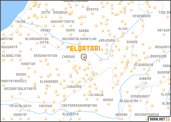
El Qataaï (Beyrouth, Lebanon)El Qataaï is a town in the Beyrouth region of Lebanon. An overview map of the region around El Qataaï is displayed below.
regional and 3d topo map of El Qataaï, Lebanon ::
El Qataaï airports ::
The nearest airport is BEY - Beirut Rafic Hariri Intl, located 45.2 km north of El Qataaï.
Other airports nearby include RPN - Rosh Pina Mahanaim I Ben Yaakov (48.8 km south), HFA - Haifa (78.4 km south west), DAM - Damascus Intl (96.3 km east), OMF - Mafraq King Hussein (138.1 km south east), Nearby towns ::
Habboûch (0.9km south east) //
Al ‘Arīḑ (1.6km south) //
Kfar Jaouz (1.9km south) //
El Maqâtlé (1.8km south west) //
Es Safha (2.2km south west) //
Dayr az Zahrānī (2.5km north west) //
Maghâyer Mahali (2.8km south east) //
Ej Jazâyer (2.9km south) //
El Machgharâni (2.7km south west) //
El Kfoûr (2.7km south west) //
Er Rejem (2.9km south west) //
El Ouazzâne (2.7km east) //
El Massâhîb (3.3km south east) //
Kfar Roummâne (3.4km south east) //
Kfar Roummâne (3.4km south east) //
Châouié (3.1km west) //
El Baïyâd (3.7km south) //
Ḩūmīn al Fawqā (3.6km north east) //
El Meidâne (3.9km south) //
Nabatîyé et Tahta (4.0km south) //
Mazra‘at al Ḩumaylah (4.2km north) //
Es Salâm (4.3km south) //
Es Sarâya (4.3km south) //
Ech Choûmé (3.9km north east) //
Mazraat Toûl (4.0km south west) //
Ouâdi Zebdîne (4.6km south) //
Bayâd en Nabi (4.3km south west) //
Aarab Salîm (4.1km north east) //
El Hadeb (4.6km north east) //
[all distances 'as the bird flies' and approximate] 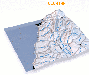 Places with similar names to El Qataaï, Lebanon ::
Disclaimer :: Information on this page comes without warranty of any kind |
||
|
Where is El Qataaï? Elevation and coordinates ::
Latitude (lat): 33°24'50"N Longitude (lon): 35°28'45"E
Elevation (approx.): 437m (map arrows pan, magnifying glasses zoom) |
||
|
Visiting El Qataaï? Hotel/Accommodation ::
Book a hotel in El Qataaï Travel Guide ::
Buy a travel guide for Lebanon rental cars ::
car rental offers GPS waypoint ::
download a GPX waypoint (PoI) of El Qataaï for your GPS receiver
|
||