|
search place name
|
||
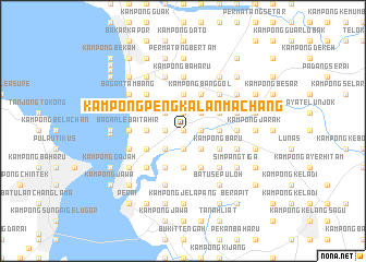
Kampong Pengkalan Machang (Pulau Pinang, Malaysia)Kampong Pengkalan Machang is a town in the Pulau Pinang region of Malaysia. An overview map of the region around Kampong Pengkalan Machang is displayed below.
regional and 3d topo map of Kampong Pengkalan Machang, Malaysia ::
Kampong Pengkalan Machang airports ::
The nearest airport is PEN - Penang Intl, located 24.2 km south west of Kampong Pengkalan Machang.
Other airports nearby include AOR - Alor Setar Sultan Abdul Halim (81.9 km north), IPH - Ipoh Sultan Azlan Shah (121.9 km south east), LGK - Pulau Langkawi Intl (124.7 km north west), HDY - Songkhla Hat Yai Intl (164.1 km north), Nearby towns ::
Sungai Dua (0.0km north) //
Permatang Che' Tak (1.8km west) //
Sungai Lokan (1.8km west) //
Kampong Telok (1.8km west) //
Kampong Kota (1.9km south) //
Permatang Sungai Dua (1.9km north) //
Kampong Padang (1.9km south) //
Kampong Permatang Sungai Dua (1.9km north) //
Kampong Guar Kepayang (1.9km north) //
Kampong Tebiar (1.9km north) //
Pengkalan Tambang (1.9km south) //
Paya Ayer Hitam (1.8km east) //
Merbau Kudong (1.8km east) //
Laboh Banting (1.8km east) //
Kampong Terus (1.8km east) //
Permatang Tok Bidan (2.6km north west) //
Kampong Tanjong Putus (2.6km south west) //
Kampong Kubu (2.6km south east) //
Ayer Hitam (2.6km north east) //
Lok Meriam (2.6km north east) //
Kampong Nyiur Sebatang (2.6km north east) //
Pokok Keras (3.7km west) //
Permatang Tok Jaya (3.7km west) //
Sungai Puyu (3.7km west) //
Maklom (3.7km west) //
Simpang Ampat (3.7km north) //
Permatang Pasir (3.7km south) //
Permatang Buloh (3.7km north) //
Kampong Tok Hamid (3.7km north) //
[all distances 'as the bird flies' and approximate] 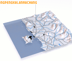 Places with similar names to Kampong Pengkalan Machang, Malaysia ::
// Kampong Pangkalan Empat (MY)
// Kampong Pangkalan Kuap (MY)
// Kampong Pangkal Nering (MY)
// Kampong Pangkal Nering (MY)
// Kampong Pengkalan (MY)
// Kampong Pengkalan (MY)
// Kampong Pengkalan (MY)
// Kampong Pengkalan (MY)
// Kampong Pengkalan (MY)
// Kampong Pengkalan Ajal (MY)
Disclaimer :: Information on this page comes without warranty of any kind |
||
|
Where is Kampong Pengkalan Machang? Elevation and coordinates ::
Latitude (lat): 5°27'0"N Longitude (lon): 100°26'0"E
Elevation (approx.): 7m (map arrows pan, magnifying glasses zoom) |
||
|
Visiting Kampong Pengkalan Machang? Hotel/Accommodation ::
Book a hotel in Kampong Pengkalan Machang Travel Guide ::
Buy a travel guide for Malaysia rental cars ::
car rental offers GPS waypoint ::
download a GPX waypoint (PoI) of Kampong Pengkalan Machang for your GPS receiver
|
||