|
search place name
|
||
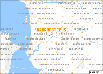
Kampong Terus (Pulau Pinang, Malaysia)Kampong Terus is a town in the Pulau Pinang region of Malaysia. An overview map of the region around Kampong Terus is displayed below.
regional and 3d topo map of Kampong Terus, Malaysia ::
Kampong Terus airports ::
The nearest airport is PEN - Penang Intl, located 25.6 km south west of Kampong Terus.
Other airports nearby include AOR - Alor Setar Sultan Abdul Halim (82.0 km north), IPH - Ipoh Sultan Azlan Shah (120.8 km south east), LGK - Pulau Langkawi Intl (125.9 km north west), HDY - Songkhla Hat Yai Intl (164.1 km north), Nearby towns ::
Merbau Kudong (0.0km north) //
Laboh Banting (0.0km north) //
Paya Ayer Hitam (0.0km north) //
Kampong Kubu (1.9km south) //
Lok Meriam (1.9km north) //
Ayer Hitam (1.9km north) //
Kampong Nyiur Sebatang (1.9km north) //
Sungai Dua (1.8km west) //
Tok Jawa (1.8km east) //
Kampong Pengkalan Machang (1.8km west) //
Kampong Padang Songson (2.6km north east) //
Kampong Lahar Yooi (2.6km north east) //
Kampong Kota (2.6km south west) //
Kampong Padang (2.6km south west) //
Kampong Baru (2.6km south east) //
Kampong Padang Tembesu (2.6km south east) //
Kampong Guar Kepayang (2.6km north west) //
Padang Buloh (2.6km south east) //
Padang Ibu (2.6km south east) //
Pengkalan Tambang (2.6km south west) //
Permatang Sungai Dua (2.6km north west) //
Kampong Permatang Sungai Dua (2.6km north west) //
Kampong Tebiar (2.6km north west) //
Guar Petai (3.7km east) //
Kampong Banggol (3.7km north) //
Kampong Padang Kerai Kechil (3.7km north) //
Permatang Ara (3.7km south) //
Sungai Lokan (3.7km west) //
Permatang Che' Tak (3.7km west) //
[all distances 'as the bird flies' and approximate] 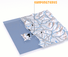 Places with similar names to Kampong Terus, Malaysia ::
// Kampong Teras (MY)
// Kampong Teras (MY)
// Kampong Teras (MY)
// Kampong Terasi (MY)
// Kampong Teris (MY)
// Kampong Teris (MY)
// Kampong Teris (MY)
// Kampong Teriso (MY)
// Kampong Terus (MY)
// Kampong Terus (MY)
Disclaimer :: Information on this page comes without warranty of any kind |
||
|
Where is Kampong Terus? Elevation and coordinates ::
Latitude (lat): 5°27'0"N Longitude (lon): 100°27'0"E
Elevation (approx.): 4m (map arrows pan, magnifying glasses zoom) |
||
|
Visiting Kampong Terus? Hotel/Accommodation ::
Book a hotel in Kampong Terus Travel Guide ::
Buy a travel guide for Malaysia rental cars ::
car rental offers GPS waypoint ::
download a GPX waypoint (PoI) of Kampong Terus for your GPS receiver
|
||