|
search place name
|
||
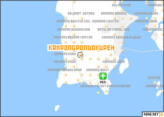
Kampong Pondok Upeh (Pulau Pinang, Malaysia)Kampong Pondok Upeh is a town in the Pulau Pinang region of Malaysia. An overview map of the region around Kampong Pondok Upeh is displayed below.
regional and 3d topo map of Kampong Pondok Upeh, Malaysia ::
Kampong Pondok Upeh airports ::
The nearest airport is PEN - Penang Intl, located 6.3 km south east of Kampong Pondok Upeh.
Other airports nearby include AOR - Alor Setar Sultan Abdul Halim (96.4 km north), LGK - Pulau Langkawi Intl (123.6 km north west), IPH - Ipoh Sultan Azlan Shah (127.4 km south east), HDY - Songkhla Hat Yai Intl (177.8 km north), Nearby towns ::
Kampong Setul (0.0km north) //
Simpang Ampat (1.8km west) //
Kampong Shee Tan (1.8km west) //
Kampong Paya (1.8km west) //
Genting (1.8km west) //
Ayer Puteh (1.9km north) //
Kampong Titi Serong (1.9km north) //
Permatang Timbun (1.9km north) //
Kampong Permatang Timbun (1.9km north) //
Balik Pulau (1.9km north) //
Kampong Kafri (1.8km east) //
Kampong Terang (2.6km south west) //
Kampong Jalan Baharu (2.6km north west) //
Kampong Paya Kongsi (2.6km north west) //
Kampong Permatang Tengah (2.6km north west) //
Kampong Enam (3.7km west) //
Kampong Sungai Burong (3.7km west) //
Kampong Masjid (3.7km south) //
Kampong Matahari Jatoh (3.7km south) //
Kampong Tengah (3.7km south) //
Kampong Titi Tras (3.7km north) //
Kampong Batak (3.7km east) //
Kampong Sungai Ara (3.7km east) //
Kampong Enam (4.1km south west) //
Kampong Perlis (4.1km south west) //
Kampong Seronok (4.1km south east) //
Kampong Bagan Ayer Itam (4.1km north west) //
Titi Perupok (4.1km north west) //
Pokok Manggis (4.1km north west) //
[all distances 'as the bird flies' and approximate] 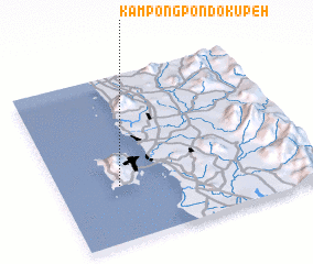 Places with similar names to Kampong Pondok Upeh, Malaysia :: Disclaimer :: Information on this page comes without warranty of any kind |
||
|
Where is Kampong Pondok Upeh? Elevation and coordinates ::
Latitude (lat): 5°20'0"N Longitude (lon): 100°14'0"E
Elevation (approx.): 73m (map arrows pan, magnifying glasses zoom) |
||
|
Visiting Kampong Pondok Upeh? Hotel/Accommodation ::
Book a hotel in Kampong Pondok Upeh Travel Guide ::
Buy a travel guide for Malaysia rental cars ::
car rental offers GPS waypoint ::
download a GPX waypoint (PoI) of Kampong Pondok Upeh for your GPS receiver
|
||