|
search place name
|
||
Kampong Sungai Tiram (Pulau Pinang, Malaysia)Kampong Sungai Tiram is a town in the Pulau Pinang region of Malaysia. An overview map of the region around Kampong Sungai Tiram is displayed below.
regional and 3d topo map of Kampong Sungai Tiram, Malaysia ::

Kampong Sungai Tiram airports ::
The nearest airport is PEN - Penang Intl, located 0.8 km south west of Kampong Sungai Tiram.
Other airports nearby include AOR - Alor Setar Sultan Abdul Halim (99.2 km north), IPH - Ipoh Sultan Azlan Shah (120.8 km south east), LGK - Pulau Langkawi Intl (129.4 km north west), HDY - Songkhla Hat Yai Intl (181.0 km north), Nearby towns ::
Kampong Naran (0.0km north) //
Kampong Bukit (1.8km west) //
Kampong Perlis (1.8km west) //
Kampong Masjid (1.8km west) //
Batu Maung (1.9km south) //
Kampong Telok Tempoyak Kechil (1.9km south) //
Kampong Pulau (1.9km north) //
Kampong Sungai Keluang (1.9km north) //
Kampong Pengkalan (1.9km north) //
Kampong Batu Maung (1.9km south) //
Nangka Mambong (1.9km north) //
Kampong Masjid (1.9km south) //
Kampong Gedong (1.9km north) //
Permatang Damar Laut (1.9km south) //
Bagan Batu Maung (1.9km south) //
Kampong Permatang Damar Laut (2.6km south west) //
Kampong Sepuloh (2.6km north west) //
Kampong Permatang Masjid (2.6km south west) //
Kampong Permatang Tepi Laut (2.6km south west) //
Kongsi Sepuloh (2.6km north west) //
Permatang Bakar Kapor (2.6km south west) //
Kampong Permatang Pak Ali Rahman (2.6km south west) //
Bayan Lepas (2.6km south west) //
Kampong Jawa (2.6km north east) //
Kampong Permatang Rumenia (2.6km north east) //
Kampong Seronok (3.7km west) //
Kampong Pulau Tengah (3.7km north) //
Relau (3.7km north) //
Kampong Seberang Paya (3.7km north) //
[all distances 'as the bird flies' and approximate] 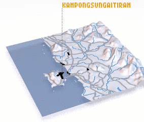 Places with similar names to Kampong Sungai Tiram, Malaysia ::
Disclaimer :: Information on this page comes without warranty of any kind |
||
|
Where is Kampong Sungai Tiram? Elevation and coordinates ::
Latitude (lat): 5°18'0"N Longitude (lon): 100°17'0"E
Elevation (approx.): 6m (map arrows pan, magnifying glasses zoom) |
||
|
Visiting Kampong Sungai Tiram? Hotel/Accommodation ::
Book a hotel in Kampong Sungai Tiram Travel Guide ::
Buy a travel guide for Malaysia rental cars ::
car rental offers GPS waypoint ::
download a GPX waypoint (PoI) of Kampong Sungai Tiram for your GPS receiver
|
||