|
search place name
|
||
Faldal (Coclé, Panama)Faldal is a town in the Coclé region of Panama. An overview map of the region around Faldal is displayed below.
regional and 3d topo map of Faldal, Panama ::

Faldal airports ::
The nearest airport is HOW - Howard, located 113.1 km east of Faldal.
Other airports nearby include PAC - Panama Marcos A Gelabert Intl (118.9 km east), PTY - Panama City Tocumen Intl (139.8 km east), BOC - Bocas Del Toro Intl (190.6 km west), DAV - David Enrique Malek Intl (204.4 km west), Nearby towns ::
San Juan (1.8km west) //
Limón (1.9km south) //
Turbe (4.1km north west) //
Machoncito (5.5km east) //
Juan Julio (5.8km east) //
Sardina (6.6km north east) //
Palmarazo (6.6km south west) //
Coclecito (9.2km north east) //
[all distances 'as the bird flies' and approximate] 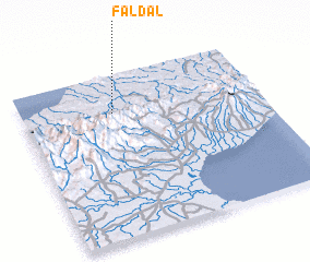 Places with similar names to Faldal, Panama ::
// Filettole (IT)
// Velotoúla (GR)
// Vila de Ala (PT)
// Flatla (NO)
// Fløtlia (NO)
// Foldal (NO)
// Folldal (NO)
// Valldal (NO)
// Flautilla (CU)
// Valea Itului (RO)
Disclaimer :: Information on this page comes without warranty of any kind |
||
|
Where is Faldal? Elevation and coordinates ::
Latitude (lat): 8°46'0"N Longitude (lon): 80°37'0"W
Elevation (approx.): 98m (map arrows pan, magnifying glasses zoom) |
||
|
Visiting Faldal? Hotel/Accommodation ::
Book a hotel in Faldal Travel Guide ::
Buy a travel guide for Panama rental cars ::
car rental offers GPS waypoint ::
download a GPX waypoint (PoI) of Faldal for your GPS receiver
|
||