|
search place name
|
||
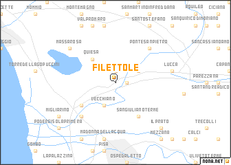
Filettole (Italy)Filettole is a town in Italy. An overview map of the region around Filettole is displayed below.
regional and 3d topo map of Filettole, Italy ::
Filettole airports ::
The nearest airport is PSA - Pisa, located 14.8 km south of Filettole.
Other airports nearby include FLR - Firenze (64.8 km east), SAY - Siena Ampugnano (93.0 km south east), BLQ - Bologna (106.9 km north east), PMF - Parma (112.3 km north), Nearby towns ::
Balbano (1.9km north) //
Ripafratta (1.3km east) //
Cerasomma (3.3km north east) //
Vecchiano (3.9km south) //
Quiesa (4.6km north west) //
San Giuliano Terme (6.2km south east) //
Malaventre (5.5km south west) //
Fiocina (6.9km south west) //
Ponte San Pietro (6.9km north east) //
Massarosa (7.7km north west) //
Il Prato (9.1km south east) //
[all distances 'as the bird flies' and approximate] 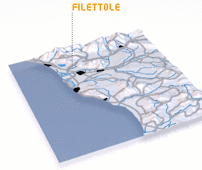 Places with similar names to Filettole, Italy ::
// Faldal (PA)
// Velotoúla (GR)
// Vila de Ala (PT)
// Flatla (NO)
// Fløtlia (NO)
// Foldal (NO)
// Folldal (NO)
// Valldal (NO)
// Flautilla (CU)
// Valea Itului (RO)
Disclaimer :: Information on this page comes without warranty of any kind |
||
|
Where is Filettole? Elevation and coordinates ::
Latitude (lat): 43°49'0"N Longitude (lon): 10°24'0"E
Elevation (approx.): 43m (map arrows pan, magnifying glasses zoom) |
||
|
Visiting Filettole? Hotel/Accommodation ::
Book a hotel in Filettole Travel Guide ::
Buy a travel guide for Italy rental cars ::
car rental offers GPS waypoint ::
download a GPX waypoint (PoI) of Filettole for your GPS receiver
|
||