|
search place name
|
||
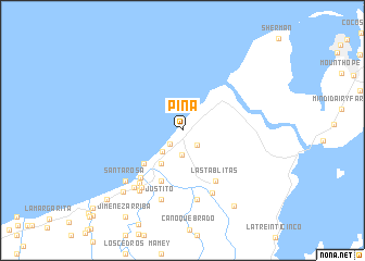
Piña (Colón, Panama)Piña is a town in the Colón region of Panama. An overview map of the region around Piña is displayed below.
regional and 3d topo map of Piña, Panama ::
Piña airports ::
The nearest airport is HOW - Howard, located 63.7 km south east of Piña.
Other airports nearby include PAC - Panama Marcos A Gelabert Intl (63.8 km south east), PTY - Panama City Tocumen Intl (76.5 km east), Nearby towns ::
Punta del Medio (1.9km south west) //
Río del Medio (2.1km south east) //
Tarascón (2.6km south) //
Punta Grande (3.0km south west) //
Santa Marta (4.0km south west) //
Santa Fe (5.2km south west) //
Paulinito (5.6km south) //
Las Tablitas (6.2km south east) //
Nuevo Chagres (6.4km south west) //
Palmas Bellas (6.9km south west) //
Achiote (7.1km south east) //
Mono Macho (7.2km south) //
Dos Hermanas (7.2km south) //
Pueblo Nuevo (7.2km south west) //
Justito (7.4km south) //
Mateo (7.6km south west) //
La Margarita (7.7km south west) //
Santa Rosa (7.8km south west) //
Los Algarrobos (8.7km south west) //
Providencia (9.3km south east) //
Los Camarones (10.4km south west) //
[all distances 'as the bird flies' and approximate] 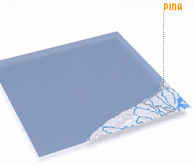 Places with similar names to Piña, Panama ::
Disclaimer :: Information on this page comes without warranty of any kind |
||
|
Where is Piña? Elevation and coordinates ::
Latitude (lat): 9°16'49"N Longitude (lon): 80°2'50"W
Elevation (approx.): 5m (map arrows pan, magnifying glasses zoom) |
||
|
Visiting Piña? Hotel/Accommodation ::
Book a hotel in Piña Travel Guide ::
Buy a travel guide for Panama rental cars ::
car rental offers GPS waypoint ::
download a GPX waypoint (PoI) of Piña for your GPS receiver
|
||