|
search place name
|
||
Aş Şalāḩīyah (Al Qādisīyah, Iraq)Aş Şalāḩīyah is a town in the Al Qādisīyah region of Iraq. An overview map of the region around Aş Şalāḩīyah is displayed below.
regional and 3d topo map of Aş Şalāḩīyah, Iraq ::

Nearby towns ::
Al ‘Abţānīyah (0.8km north) //
Qaryat as Suray‘ (2.1km north west) //
Ghāzī Āl ‘Arūs (3.9km north west) //
Qaryat al ‘Āfandīyah (4.2km south) //
Sayyid Dāfil al Bādī (4.1km south east) //
Āl Suray‘ (5.0km south east) //
Qaryat al Khālid (5.8km north west) //
Ash Shāmīyah (7.0km north) //
Shahīd ‘Ulaywī (7.3km south) //
Dadham ar Rāshid (7.1km south west) //
Al Wārishīyah (8.6km north west) //
Abū Saddah (8.2km south west) //
Şudūr ash Shallāl (8.5km south west) //
Al Ghādūrī (8.5km north west) //
Sayyid ‘Adhari (9.5km south west) //
Qaryat Ḩarīchah (9.5km north east) //
Qaryat ash Shallāl (10.1km south west) //
[all distances 'as the bird flies' and approximate] 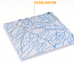 Places with similar names to Aş Şalāḩīyah, Iraq ::
// Aş Şāliḩīyah (BH)
// Aş Şalāḩīyah (IQ)
// Aş Şāliḩīyah (IQ)
// Aş Şāliḩīyah (IQ)
// Aş -āliḩīyah (EG)
// Aş Şālḩīyah (EG)
// Aş Şāliḩīyah (EG)
// Aş Şāliḩīyah (EG)
// Aş Şāliḩīyah (EG)
// As Şāliḩīyah (EG)
Disclaimer :: Information on this page comes without warranty of any kind |
||
|
Where is Aş Şalāḩīyah? Elevation and coordinates ::
Latitude (lat): 31°53'59"N Longitude (lon): 44°35'50"E
Elevation (approx.): 25m (map arrows pan, magnifying glasses zoom) |
||
|
Visiting Aş Şalāḩīyah? Hotel/Accommodation ::
Book a hotel in Aş Şalāḩīyah Travel Guide ::
Buy a travel guide for Iraq rental cars ::
car rental offers GPS waypoint ::
download a GPX waypoint (PoI) of Aş Şalāḩīyah for your GPS receiver
|
||