|
search place name
|
||
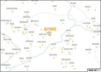
Diyārī (Arbīl, Iraq)Diyārī is a town in the Arbīl region of Iraq. An overview map of the region around Diyārī is displayed below.
regional and 3d topo map of Diyārī, Iraq ::
Diyārī airports ::
The nearest airport is VAN - Van, located 156.3 km north west of Diyārī.
Nearby towns ::
Minish (0.7km north) //
Keryādērī (1.7km north west) //
Khalka (2.3km west) //
Māmīsa (3.6km north west) //
Gūzē (4.4km south) //
Hiriyash (4.1km south west) //
Sīnā (4.6km south) //
Sūriya (5.2km south west) //
Mīrwānīsh (5.5km north west) //
Barkalē (5.6km south east) //
Mīrūs (5.9km south east) //
Mēzī (6.0km north east) //
Duhik (5.5km west) //
Sūmē (5.8km south east) //
Tūyē (5.6km east) //
Bēnista (6.3km north west) //
Rawīyān (5.9km east) //
Kurān (6.9km south east) //
Warkhil (6.7km south west) //
Pālāna (8.1km south) //
Silūr (6.9km east) //
Bīzhiyān (8.1km south east) //
Būsē (8.8km south east) //
Bāwa (8.9km south west) //
Narvak (9.2km north west) //
Zēwa (10.4km north west) //
[all distances 'as the bird flies' and approximate] 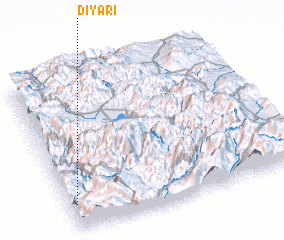 Places with similar names to Diyārī, Iraq ::
Disclaimer :: Information on this page comes without warranty of any kind |
||
|
Where is Diyārī? Elevation and coordinates ::
Latitude (lat): 37°10'19"N Longitude (lon): 44°1'36"E
Elevation (approx.): 981m (map arrows pan, magnifying glasses zoom) |
||
|
Visiting Diyārī? Hotel/Accommodation ::
Book a hotel in Diyārī Travel Guide ::
Buy a travel guide for Iraq rental cars ::
car rental offers GPS waypoint ::
download a GPX waypoint (PoI) of Diyārī for your GPS receiver
|
||