|
search place name
|
||
Mullā ‘Abd Allāh (At Taʼmīm, Iraq)Mullā ‘Abd Allāh is a town in the At Taʼmīm region of Iraq. An overview map of the region around Mullā ‘Abd Allāh is displayed below.
regional and 3d topo map of Mullā ‘Abd Allāh, Iraq ::

Nearby towns ::
Idrīs Sulţān (2.0km north east) //
Habītar (4.3km south) //
Idrīs Khabbāz (3.9km north east) //
Al Buwaytīr (4.4km south) //
Hindī Tappah (4.6km south east) //
Dawrām (5.9km north west) //
Jadīdah (6.4km south) //
Şābūnchī (6.6km north) //
Ash Sharīfīyah (6.1km south east) //
Idrīs Kākah ‘Abd Allāh (6.3km north east) //
Yangī Damlār (6.7km south east) //
Kawāz Qarah Bayt (8.0km south) //
Dawrām (7.0km north west) //
Kawāz Ḩājjī Jamīl (8.3km south) //
Rāmī (7.5km north east) //
Idrīs ‘Arab (8.2km north east) //
Kīnah Rivi (8.6km north) //
Ţaqţaq (9.7km north west) //
Barīmah (9.3km south west) //
[all distances 'as the bird flies' and approximate] 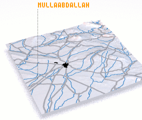 Places with similar names to Mullā ‘Abd Allāh, Iraq ::
// Mollā ‘Abdollāh (IR)
Disclaimer :: Information on this page comes without warranty of any kind |
||
|
Where is Mullā ‘Abd Allāh? Elevation and coordinates ::
Latitude (lat): 35°28'16"N Longitude (lon): 44°7'34"E
Elevation (approx.): 241m (map arrows pan, magnifying glasses zoom) |
||
|
Visiting Mullā ‘Abd Allāh? Hotel/Accommodation ::
Book a hotel in Mullā ‘Abd Allāh Travel Guide ::
Buy a travel guide for Iraq rental cars ::
car rental offers GPS waypoint ::
download a GPX waypoint (PoI) of Mullā ‘Abd Allāh for your GPS receiver
|
||