|
search place name
|
||
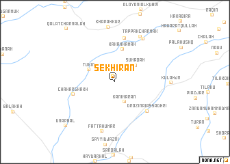
Sekhīrān (As Sulaymānīyah, Iraq)Sekhīrān is a town in the As Sulaymānīyah region of Iraq. An overview map of the region around Sekhīrān is displayed below.
regional and 3d topo map of Sekhīrān, Iraq ::
Sekhīrān airports ::
The nearest airport is SDG - Sanandaj, located 182.9 km east of Sekhīrān.
Nearby towns ::
Kānī Marān (3.5km south) //
Sumāqah (3.9km north east) //
Tūkīn (4.0km north west) //
Kākah Hamah (5.4km north) //
Drozina-i Aşşaghrī (6.4km south east) //
Chahār Shākh (5.9km west) //
Alayān-i Aşşaghrī (7.3km north) //
Fattāḩ ‘Umar (8.3km south) //
Tepeh Spī (8.0km north east) //
Tappah Charmak (8.1km north east) //
‘Umar Bal (9.7km south west) //
Qal‘at Chārmālah (10.8km north west) //
[all distances 'as the bird flies' and approximate] 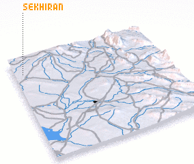 Places with similar names to Sekhīrān, Iraq ::
// Zakhar'ino (RU)
// Zakhar'ino (RU)
// Zakhar'ino (RU)
// Zakhar'ino (RU)
// Zakhar'ino (RU)
// Zakhar'ino (RU)
// Zakhar'ino (RU)
// Zakhar'ino (RU)
// Zakhar'ino (RU)
// Zakhar'ino (RU)
Disclaimer :: Information on this page comes without warranty of any kind |
||
|
Where is Sekhīrān? Elevation and coordinates ::
Latitude (lat): 34°51'1"N Longitude (lon): 45°3'45"E
Elevation (approx.): 456m (map arrows pan, magnifying glasses zoom) |
||
|
Visiting Sekhīrān? Hotel/Accommodation ::
Book a hotel in Sekhīrān Travel Guide ::
Buy a travel guide for Iraq rental cars ::
car rental offers GPS waypoint ::
download a GPX waypoint (PoI) of Sekhīrān for your GPS receiver
|
||