|
search place name
|
||
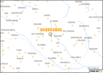
Akbarābād (Khorāsān, Iran)Akbarābād is a town in the Khorāsān region of Iran. An overview map of the region around Akbarābād is displayed below.
regional and 3d topo map of Akbarābād, Iran ::
Akbarābād airports ::
The nearest airport is XBJ - Birjand, located 42.7 km south west of Akbarābād.
Nearby towns ::
Kalāt-e Barāt (1.4km south) //
Kalāteh-ye Farhang (1.5km south) //
Serījān (2.3km south east) //
Cheshmeh-ye Labāfān (2.7km west) //
Naşrābād (3.2km north) //
Bīdesk (3.9km north) //
Āvīshk (3.9km north) //
Cheshmeh-ye Qand (3.6km north west) //
Sīk (4.1km south east) //
Galū Cheshmeh-ye Sorkh (3.6km east) //
‘Alīābād (4.6km north) //
Pīr Zanūk (4.9km south) //
Seyyedābād (4.1km west) //
‘Alīābād (5.0km south west) //
Latī (4.8km west) //
Qadamgāh-e Ḩalqeh Gūshī (5.2km north west) //
Negīnān (5.3km north west) //
Khorū (6.8km north) //
Darreh ‘Abbās (6.3km south east) //
‘Abdoleh (7.3km south) //
Monond (7.5km north east) //
Tangal (7.5km south east) //
Fazlābād (8.6km south) //
Zīgīcheh-ye Pā'īn (7.8km east) //
Shūshūd (9.3km south west) //
[all distances 'as the bird flies' and approximate] 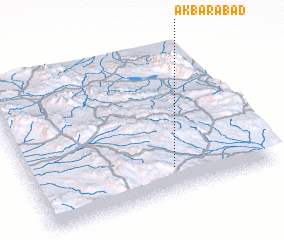 Places with similar names to Akbarābād, Iran ::
Disclaimer :: Information on this page comes without warranty of any kind |
||
|
Where is Akbarābād? Elevation and coordinates ::
Latitude (lat): 33°9'55"N Longitude (lon): 59°35'42"E
Elevation (approx.): 2139m (map arrows pan, magnifying glasses zoom) |
||
|
Visiting Akbarābād? Hotel/Accommodation ::
Book a hotel in Akbarābād Travel Guide ::
Buy a travel guide for Iran rental cars ::
car rental offers GPS waypoint ::
download a GPX waypoint (PoI) of Akbarābād for your GPS receiver
|
||