|
search place name
|
||
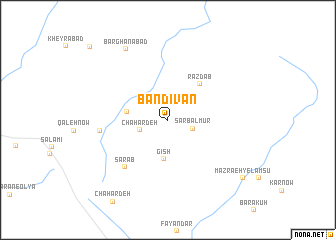
Bandīvān (Khorāsān, Iran)Bandīvān is a town in the Khorāsān region of Iran. An overview map of the region around Bandīvān is displayed below.
regional and 3d topo map of Bandīvān, Iran ::
Bandīvān airports ::
The nearest airport is XBJ - Birjand, located 221.8 km south of Bandīvān.
Nearby towns ::
Sarbalmūr (2.5km south east) //
Chahār Deh (2.8km south west) //
Gīsh (4.4km south) //
Band-e Salāmī (3.9km west) //
Razdāb (5.0km north east) //
Sarāb (6.6km south west) //
Qal‘eh Now (6.3km west) //
Barghanābād (8.8km north west) //
Mazra‘eh-ye Lamsū (9.5km south east) //
Kheyrābād (10.9km north west) //
[all distances 'as the bird flies' and approximate] 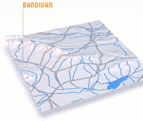 Places with similar names to Bandīvān, Iran ::
// Bannteufen (AT)
// Ban Na Ta Phan (TH)
// Bandevān (IR)
// Ban Taophan (LA)
// Ban Taphan (LA)
// Ban Taphan (LA)
// Ban Tavèn (LA)
// Ban Taveun (LA)
// Bandivan (AM)
Disclaimer :: Information on this page comes without warranty of any kind |
||
|
Where is Bandīvān? Elevation and coordinates ::
Latitude (lat): 34°46'31"N Longitude (lon): 60°5'30"E
Elevation (approx.): 1259m (map arrows pan, magnifying glasses zoom) |
||
|
Visiting Bandīvān? Hotel/Accommodation ::
Book a hotel in Bandīvān Travel Guide ::
Buy a travel guide for Iran rental cars ::
car rental offers GPS waypoint ::
download a GPX waypoint (PoI) of Bandīvān for your GPS receiver
|
||