|
search place name
|
||
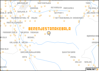
Berenjestānak-e Bālā (Iran)Berenjestānak-e Bālā is a town in Iran. An overview map of the region around Berenjestānak-e Bālā is displayed below.
regional and 3d topo map of Berenjestānak-e Bālā, Iran ::
Berenjestānak-e Bālā airports ::
The nearest airport is THR - Teheran Mehrabad Intl, located 165.6 km south west of Berenjestānak-e Bālā.
Nearby towns ::
Berenjestānak (1.5km north west) //
Yāgh Kūh (4.5km west) //
Chepī (6.9km north) //
Beshel (5.7km west) //
Gol Afshān (7.4km north) //
Seyyed Abū Şāleḩ (7.1km north east) //
Rajeh (7.1km north west) //
Seyf Kotī (8.0km north) //
Emāmzādeh ‘Eyn‘alī (8.0km north) //
Andār Kolī (7.0km south west) //
Āhangar Kolā-ye Bīsheh Sar (8.1km north) //
Vosţá Kolā (8.2km north west) //
Chālī (8.2km south west) //
Āb Dang Sar (8.0km south west) //
Shīr Gāh (9.2km south west) //
Sarchāk-e Ḩājjīābād (9.3km south west) //
Maleh (9.4km north east) //
Sūkhteh Sarā (9.5km south east) //
Qādī Kolā-ye Bozorg (9.6km north west) //
Zīvalā (10.4km south west) //
[all distances 'as the bird flies' and approximate]  Places with similar names to Berenjestānak-e Bālā, Iran :: Disclaimer :: Information on this page comes without warranty of any kind |
||
|
Where is Berenjestānak-e Bālā? Elevation and coordinates ::
Latitude (lat): 36°22'0"N Longitude (lon): 52°57'0"E
Elevation (approx.): 184m (map arrows pan, magnifying glasses zoom) |
||
|
Visiting Berenjestānak-e Bālā? Hotel/Accommodation ::
Book a hotel in Berenjestānak-e Bālā Travel Guide ::
Buy a travel guide for Iran rental cars ::
car rental offers GPS waypoint ::
download a GPX waypoint (PoI) of Berenjestānak-e Bālā for your GPS receiver
|
||