|
search place name
|
||
Chāchīlīyeh (Iran)Chāchīlīyeh is a town in Iran. An overview map of the region around Chāchīlīyeh is displayed below.
regional and 3d topo map of Chāchīlīyeh, Iran ::
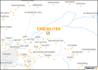
Nearby towns ::
Ḩasanābād-e Kachalī (0.1km north east) //
Ḩoseynābād-e Kachalī (1.6km north) //
Zamānābād (1.8km south) //
Mūlenjān (2.5km south west) //
Qahjāverestān (3.9km south east) //
Dīnān (4.0km south west) //
Haft Shūyeh (4.4km south west) //
Jolmarz (5.0km south) //
Mūrnān (5.4km south west) //
Bahārān (6.1km south west) //
Āmorzīdehābād (5.9km south east) //
Andevān (6.2km south west) //
Gīān (6.8km south west) //
Hasteh (6.4km south west) //
Jelvān (6.5km south west) //
Qal‘eh Now-e Khātūnābād (7.6km south) //
Ḩatmābād (7.5km south east) //
Gavart (8.6km south) //
Moḩammadābād (8.4km south west) //
Khātūnābād (8.6km south) //
Jalāderān (8.4km south east) //
Jowharān (8.4km south west) //
Rārān-e Qohāb (8.8km south west) //
Lafdān (9.0km south west) //
‘Alīābād-e Mollā ‘Alī (9.3km north west) //
Jalālābād (8.8km south east) //
Joharānjey (9.1km south west) //
Kangāz (10.4km south west) //
[all distances 'as the bird flies' and approximate] 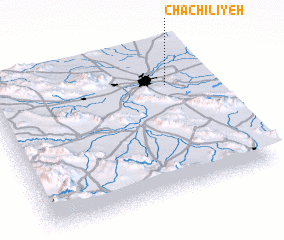 Places with similar names to Chāchīlīyeh, Iran ::
// Shosh-e ‘Olyā (AF)
// Chichilaya (BO)
// Chuchilaya (BO)
// Chuchulaya (BO)
// Shchel'ye (RU)
// Shchel'ye (RU)
Disclaimer :: Information on this page comes without warranty of any kind |
||
|
Where is Chāchīlīyeh? Elevation and coordinates ::
Latitude (lat): 32°44'0"N Longitude (lon): 51°49'0"E
Elevation (approx.): 1545m (map arrows pan, magnifying glasses zoom) |
||
|
Visiting Chāchīlīyeh? Hotel/Accommodation ::
Book a hotel in Chāchīlīyeh Travel Guide ::
Buy a travel guide for Iran rental cars ::
car rental offers GPS waypoint ::
download a GPX waypoint (PoI) of Chāchīlīyeh for your GPS receiver
|
||