|
search place name
|
||
Cher Cher (Iran)Cher Cher is a town in Iran. An overview map of the region around Cher Cher is displayed below.
regional and 3d topo map of Cher Cher, Iran ::

Cher Cher airports ::
The nearest airport is TBZ - Tabriz Intl, located 139.0 km south west of Cher Cher.
Other airports nearby include RAS - Rasht (233.3 km south east), Nearby towns ::
Qūrt Tappeh (1.7km west) //
Chenār (2.4km south east) //
Qarah Gol (3.4km south east) //
Nūly Bolāghī (4.0km north) //
Gūney Kandī (3.4km west) //
Poshteh-ye Qareh Āghāj (5.6km south) //
Sarī (5.4km north east) //
Nīāzqolī (5.7km north east) //
Mer'ātī (5.9km east) //
Borjelū (7.6km south) //
Maẕāfeh (6.6km east) //
Gerdgol (6.9km north west) //
Dāshlī Darreh (8.0km north east) //
Gol Daraq (10.5km north east) //
[all distances 'as the bird flies' and approximate] 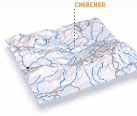 Places with similar names to Cher Cher, Iran ::
// Cherichira (TN)
// Churashur (RU)
// Churashur (RU)
// Chercher (IR)
// Cher Cherā (IR)
// Chūrchūrī (IR)
// Char Charia (BD)
// Shar-Shar (UZ)
// Shar-Shar (UZ)
// Shar Shar (IR)
Disclaimer :: Information on this page comes without warranty of any kind |
||
|
Where is Cher Cher? Elevation and coordinates ::
Latitude (lat): 38°44'0"N Longitude (lon): 47°38'0"E
Elevation (approx.): 1223m (map arrows pan, magnifying glasses zoom) |
||
|
Visiting Cher Cher? Hotel/Accommodation ::
Book a hotel in Cher Cher Travel Guide ::
Buy a travel guide for Iran rental cars ::
car rental offers GPS waypoint ::
download a GPX waypoint (PoI) of Cher Cher for your GPS receiver
|
||