|
search place name
|
||
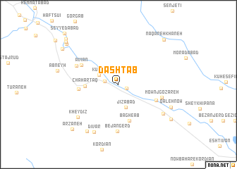
Dashtāb (Khorāsān, Iran)Dashtāb is a town in the Khorāsān region of Iran. An overview map of the region around Dashtāb is displayed below.
regional and 3d topo map of Dashtāb, Iran ::
Dashtāb airports ::
The nearest airport is HEA - Herat, located 203.1 km south east of Dashtāb.
Nearby towns ::
Robāţ (1.2km south east) //
Kāfj (1.8km west) //
Kūlāb (2.9km north west) //
Jīzābād (3.8km south) //
Chahār Ţāq (4.4km west) //
Bāgh-e Āb (5.9km south) //
Qal‘eh-ye Now Shāmlū (5.2km west) //
Now Bahār-e Gholāmān (5.5km south east) //
Āvīān (5.7km north west) //
Mownj Gozareh (6.0km east) //
Ābkhīzeh (6.2km north west) //
Bejangerd (7.4km south) //
Kheydīz (7.4km south west) //
Dīvār (8.2km south) //
Qal‘eh Now-e Shamlū (7.4km south east) //
Arkhūd (8.5km south west) //
Qal‘eh Now (7.8km south east) //
Shahr-e Now (8.8km south east) //
Naqāreh Khāneh (9.3km north east) //
Arzaneh (9.3km south west) //
Arnābād (9.3km north west) //
Sowrnābād (9.6km north west) //
Solţānābād (9.9km north west) //
Seyyedābād (10.7km north west) //
[all distances 'as the bird flies' and approximate] 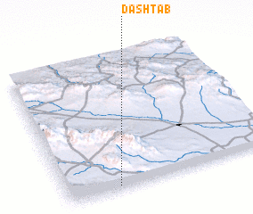 Places with similar names to Dashtāb, Iran ::
// Dāsh Deybī (IR)
// Dāshdībī (IR)
// Dasht Āb (IR)
// Dasht-e Ābī (IR)
// Doāi Chaitāba (BD)
// Tyshtebay (KZ)
// Tashtebe (KG)
Disclaimer :: Information on this page comes without warranty of any kind |
||
|
Where is Dashtāb? Elevation and coordinates ::
Latitude (lat): 35°2'5"N Longitude (lon): 60°15'3"E
Elevation (approx.): 1317m (map arrows pan, magnifying glasses zoom) |
||
|
Visiting Dashtāb? Hotel/Accommodation ::
Book a hotel in Dashtāb Travel Guide ::
Buy a travel guide for Iran rental cars ::
car rental offers GPS waypoint ::
download a GPX waypoint (PoI) of Dashtāb for your GPS receiver
|
||