|
search place name
|
||
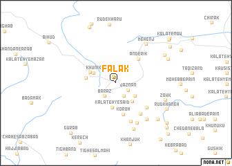
Falak (Khorāsān, Iran)Falak is a town in the Khorāsān region of Iran. An overview map of the region around Falak is displayed below.
regional and 3d topo map of Falak, Iran ::
Falak airports ::
The nearest airport is XBJ - Birjand, located 95.6 km south of Falak.
Nearby towns ::
Jaznān (2.1km south east) //
Gazānū (2.4km south east) //
Bārāz (2.6km south west) //
Bāzār (2.6km south west) //
Bahā' ed Dīn (3.3km south east) //
Khūnīk (3.4km north west) //
Kalāteh-ye Sa‘īd (4.0km south) //
Kanārang (3.8km south east) //
Khūnīk-e Tajen (3.8km north west) //
Tajan (4.0km west) //
Koroh (5.2km south) //
Anderīk (4.9km north east) //
Eskachū (5.8km south east) //
Tajark (6.1km south east) //
Takā Band (6.5km south) //
Qolleh-ye Kaftār (7.0km south east) //
Toros Kūh (7.2km south east) //
Mehenj (7.5km north east) //
Saftūk-e Pā'īn (7.9km south) //
Zowk (7.3km south east) //
Darreh Khākestar (8.2km south east) //
Kalāteh-ye Naşīr (8.0km north east) //
Rūdkhāneh (8.1km south east) //
Razdonbal (8.0km north east) //
‘Alīābād-e Chedān (9.5km south east) //
Naşīr (9.4km north east) //
Gūrāb (10.1km south west) //
Chodān (10.0km south east) //
Ma‘vāj (10.0km north east) //
[all distances 'as the bird flies' and approximate] 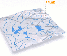 Places with similar names to Falak, Iran ::
Disclaimer :: Information on this page comes without warranty of any kind |
||
|
Where is Falak? Elevation and coordinates ::
Latitude (lat): 33°43'10"N Longitude (lon): 58°57'18"E
Elevation (approx.): 1858m (map arrows pan, magnifying glasses zoom) |
||
|
Visiting Falak? Hotel/Accommodation ::
Book a hotel in Falak Travel Guide ::
Buy a travel guide for Iran rental cars ::
car rental offers GPS waypoint ::
download a GPX waypoint (PoI) of Falak for your GPS receiver
|
||