|
search place name
|
||
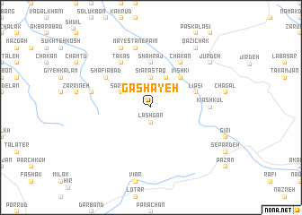
Gashāyeh (Gīlān, Iran)Gashāyeh is a town in the Gīlān region of Iran. An overview map of the region around Gashāyeh is displayed below.
regional and 3d topo map of Gashāyeh, Iran ::
Gashāyeh airports ::
The nearest airport is RZR - Ramsar, located 41.1 km north east of Gashāyeh.
Other airports nearby include RAS - Rasht (92.9 km north west), THR - Teheran Mehrabad Intl (144.5 km south east), Nearby towns ::
Lashgān (1.9km south) //
Kalrūd (2.4km north west) //
Nīāsān (3.7km north) //
Sīārastāq (3.7km north) //
Sardeh (3.5km north west) //
Sārem (4.0km north) //
Vīshkī (4.8km north east) //
Valanī (4.8km north east) //
Shāhrāj (5.6km north) //
Beleh Tork (4.8km north east) //
Līāsī (4.8km north east) //
Pūdeh (6.3km north west) //
Takās (6.3km north west) //
Shafī‘ābād (5.8km north west) //
Moʼmen Zamīn (5.8km north west) //
Chākān (6.3km north east) //
Kīāshkūl (5.9km east) //
Gūrkhānī (6.2km west) //
Māyestān-e Pā'īn (7.6km north) //
Delījān (7.6km north) //
Māyestān-e Bālā (8.0km north) //
Qāẕī Chāk (8.6km north east) //
Jūr Deh (8.1km north east) //
[all distances 'as the bird flies' and approximate] 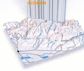 Places with similar names to Gashāyeh, Iran ::
Disclaimer :: Information on this page comes without warranty of any kind |
||
|
Where is Gashāyeh? Elevation and coordinates ::
Latitude (lat): 36°42'0"N Longitude (lon): 50°18'0"E
Elevation (approx.): 2076m (map arrows pan, magnifying glasses zoom) |
||
|
Visiting Gashāyeh? Hotel/Accommodation ::
Book a hotel in Gashāyeh Travel Guide ::
Buy a travel guide for Iran rental cars ::
car rental offers GPS waypoint ::
download a GPX waypoint (PoI) of Gashāyeh for your GPS receiver
|
||