|
search place name
|
||
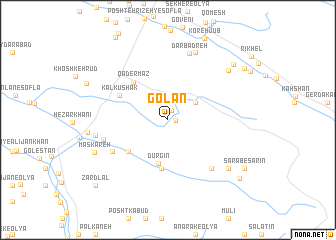
Golān (Ostān-e Kermānshāh, Iran)Golān is a town in the Ostān-e Kermānshāh region of Iran. An overview map of the region around Golān is displayed below.
regional and 3d topo map of Golān, Iran ::
Golān airports ::
The nearest airport is KSH - Bakhtaran Shahid Ashrafi Esfahani, located 42.9 km north of Golān.
Other airports nearby include SDG - Sanandaj (143.6 km north), Nearby towns ::
Hasht Bākh (0.7km east) //
Būzhān (1.1km north) //
Cheshmeh Sorkh (3.2km north east) //
Dūrgīn (4.9km south) //
Vīnah (5.4km south) //
Cheshmeh Shāhrokh (5.1km south west) //
Qāder Maz (5.2km north west) //
Kalkūshak (5.3km north west) //
Tāzehābād (6.3km south west) //
Dārshīrkhān (6.8km south east) //
Masgareh (6.3km west) //
Dārbadreh (7.7km north) //
Cherāghābād (8.0km north) //
Nūrāz (6.9km west) //
Gorgāvān (7.8km south east) //
Nāmdār (7.8km south east) //
Sāmeleh-ye ‘Olyā (7.8km north east) //
Maskareh (7.7km south west) //
Sāmeleh-ye Soflá (8.6km north east) //
Sarāb-e Sarīn (8.9km south east) //
Ahūrān (9.3km south east) //
Bāgh-e Yāsam (9.1km north east) //
Zardlal (9.9km south west) //
[all distances 'as the bird flies' and approximate]  Places with similar names to Golān, Iran ::
Disclaimer :: Information on this page comes without warranty of any kind |
||
|
Where is Golān? Elevation and coordinates ::
Latitude (lat): 33°57'55"N Longitude (lon): 47°14'22"E
Elevation (approx.): 1571m (map arrows pan, magnifying glasses zoom) |
||
|
Visiting Golān? Hotel/Accommodation ::
Book a hotel in Golān Travel Guide ::
Buy a travel guide for Iran rental cars ::
car rental offers GPS waypoint ::
download a GPX waypoint (PoI) of Golān for your GPS receiver
|
||