|
search place name
|
||
Ḩājjīābād (Khorāsān, Iran)Ḩājjīābād is a town in the Khorāsān region of Iran. An overview map of the region around Ḩājjīābād is displayed below.
regional and 3d topo map of Ḩājjīābād, Iran ::
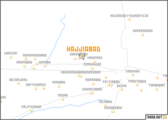
Nearby towns ::
Sar Ḩowẕak (0.9km west) //
Deh Now (1.8km north) //
Moḩammadīyeh (1.7km west) //
Kasrīneh (2.1km east) //
Zendeh Jān (2.4km south east) //
Moḩammadābād-e Sārebān (3.7km south) //
Moḩammadābād (3.7km south) //
Momrābād (5.6km south) //
Moghān (5.6km south east) //
‘Eshratābād (7.6km south) //
Showkatīyeh (7.6km south) //
Feyẕīābād (7.2km south east) //
Mīrābād (7.5km south west) //
Feyz̄īābād (7.6km south east) //
Deh Now (7.2km west) //
Neqāb (9.6km south west) //
Qūzhd (9.5km south east) //
[all distances 'as the bird flies' and approximate] 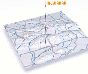 Places with similar names to Ḩājjīābād, Iran ::
Disclaimer :: Information on this page comes without warranty of any kind |
||
|
Where is Ḩājjīābād? Elevation and coordinates ::
Latitude (lat): 35°16'0"N Longitude (lon): 58°23'0"E
Elevation (approx.): 1020m (map arrows pan, magnifying glasses zoom) |
||
|
Visiting Ḩājjīābād? Hotel/Accommodation ::
Book a hotel in Ḩājjīābād Travel Guide ::
Buy a travel guide for Iran rental cars ::
car rental offers GPS waypoint ::
download a GPX waypoint (PoI) of Ḩājjīābād for your GPS receiver
|
||