|
search place name
|
||
Ḩeydarābād (Iran)Ḩeydarābād is a town in Iran. An overview map of the region around Ḩeydarābād is displayed below.
regional and 3d topo map of Ḩeydarābād, Iran ::
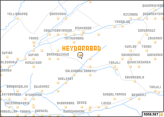
Nearby towns ::
Yekkeh Qūz-e Pā'īn (1.5km east) //
Yekkeh Qūz-e Bālā (1.5km east) //
Kalleh Dūr (2.4km north west) //
Ḩājjī Ḩasan (2.4km south east) //
Ḩājjī Golshan (2.4km south east) //
Sheykh Hā (2.4km south east) //
Kāz̧em Khvājeh (2.4km south east) //
Teymūrābād (4.0km north) //
Goneylī (4.0km south) //
Şaleḩābād (4.0km south) //
Qareh Qūzī-e Do (4.4km west) //
Chorūk (5.6km north) //
Chārābād (4.8km north west) //
Zābolābād (5.8km north) //
Pīsh Kamar (6.1km north) //
Boglīk (6.3km south west) //
Shelesat (6.3km south west) //
Ājan Sangarlī (6.3km south west) //
Kaser-e Pīshkamar (6.3km north east) //
Āq Yājī (6.3km north west) //
Qareh Qūzī-e Yek (5.9km west) //
Tarjīlī (6.2km east) //
Bolūk Ājan (7.1km south west) //
Bolānjeq (7.1km south west) //
Kowlī-ye Bāyandor (7.1km north west) //
Orjanlī (6.7km east) //
Chāhār Māzū (8.6km south west) //
Gūkjeh (8.1km north west) //
Kesr (8.1km north west) //
[all distances 'as the bird flies' and approximate] 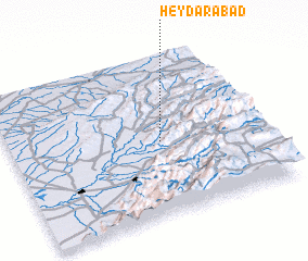 Places with similar names to Ḩeydarābād, Iran ::
// Hāydarābād (BD)
// Haidarābād (IN)
// Hāderābād (IR)
// Ḩeydarābād (IR)
// Ḩeydarābād (IR)
// Ḩeydarābād (IR)
// Ḩeydarābād (IR)
// Ḩeydarābād (IR)
// Ḩeydarābād (IR)
// Ḩeydarābād (IR)
Disclaimer :: Information on this page comes without warranty of any kind |
||
|
Where is Ḩeydarābād? Elevation and coordinates ::
Latitude (lat): 37°28'0"N Longitude (lon): 55°36'0"E
Elevation (approx.): 509m (map arrows pan, magnifying glasses zoom) |
||
|
Visiting Ḩeydarābād? Hotel/Accommodation ::
Book a hotel in Ḩeydarābād Travel Guide ::
Buy a travel guide for Iran rental cars ::
car rental offers GPS waypoint ::
download a GPX waypoint (PoI) of Ḩeydarābād for your GPS receiver
|
||