|
search place name
|
||
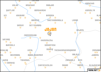
Jājān (Ostān-e Āz̄arbāyjān-e Gharbī, Iran)Jājān is a town in the Ostān-e Āz̄arbāyjān-e Gharbī region of Iran. An overview map of the region around Jājān is displayed below.
regional and 3d topo map of Jājān, Iran ::
Jājān airports ::
The nearest airport is TBZ - Tabriz Intl, located 77.1 km south west of Jājān.
Nearby towns ::
Khvoʼīn Dīzaj (2.8km south west) //
Lāleh Bejān (3.0km west) //
Goshāyesh (4.3km south) //
Sheykh Aḩmadlū (5.1km north) //
Nehrīq (5.8km south) //
Seyyedābād (5.4km north west) //
Bīrāneh (6.8km north) //
Ārpālīq (6.9km north) //
Sarājehlū (6.5km north east) //
Barāzīn (6.6km north west) //
Zarrīn Rekāb (5.9km west) //
Zarī Kand (5.9km west) //
Masqarān (7.5km south east) //
Tāzeh Kand-e Masqarān (7.5km south east) //
Āgh Kandī (7.6km north west) //
Boneh Kāghī (9.1km north) //
Āqā Bābā Sang (8.5km south west) //
Kīfāl (8.5km south west) //
Āq Bolāgh-e Pāʼīn (9.2km south west) //
Sīāh Kalān (10.2km south west) //
[all distances 'as the bird flies' and approximate]  Places with similar names to Jājān, Iran ::
Disclaimer :: Information on this page comes without warranty of any kind |
||
|
Where is Jājān? Elevation and coordinates ::
Latitude (lat): 38°39'20"N Longitude (lon): 46°49'2"E
Elevation (approx.): 2246m (map arrows pan, magnifying glasses zoom) |
||
|
Visiting Jājān? Hotel/Accommodation ::
Book a hotel in Jājān Travel Guide ::
Buy a travel guide for Iran rental cars ::
car rental offers GPS waypoint ::
download a GPX waypoint (PoI) of Jājān for your GPS receiver
|
||