|
search place name
|
||
Kafāz (Khorāsān, Iran)Kafāz is a town in the Khorāsān region of Iran. An overview map of the region around Kafāz is displayed below.
regional and 3d topo map of Kafāz, Iran ::

Kafāz airports ::
The nearest airport is XBJ - Birjand, located 111.4 km west of Kafāz.
Other airports nearby include HEA - Herat (252.4 km north east), Nearby towns ::
Narges (3.2km south) //
Lojeng-e Pā'īn (3.3km east) //
Mīshnāb (3.6km north west) //
Lojeng-e Bālā (3.6km east) //
Safāl Band (5.0km south) //
Şūlābast (4.3km west) //
Sang-e Ātesh (4.3km west) //
Sūlāvas (5.5km west) //
Sūlābast (5.5km west) //
Peygodār-e Sabz (6.4km south west) //
Qāsemābād-e Pā'īn (6.7km east) //
Qāsemābād-e Bālā (7.1km east) //
Godār-e Sīāh Darreh (8.8km south) //
Rāsk (7.9km north east) //
Pūreng (9.4km south) //
[all distances 'as the bird flies' and approximate] 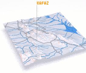 Places with similar names to Kafāz, Iran ::
Disclaimer :: Information on this page comes without warranty of any kind |
||
|
Where is Kafāz? Elevation and coordinates ::
Latitude (lat): 32°32'42"N Longitude (lon): 60°22'45"E
Elevation (approx.): 1609m (map arrows pan, magnifying glasses zoom) |
||
|
Visiting Kafāz? Hotel/Accommodation ::
Book a hotel in Kafāz Travel Guide ::
Buy a travel guide for Iran rental cars ::
car rental offers GPS waypoint ::
download a GPX waypoint (PoI) of Kafāz for your GPS receiver
|
||