|
search place name
|
||
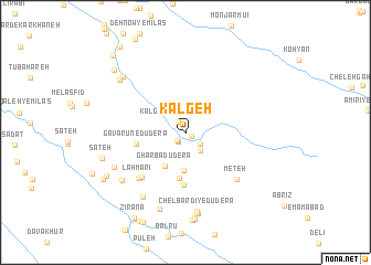
Kalgeh (Chahār Maḩāll va Bakhtīār, Iran)Kalgeh is a town in the Chahār Maḩāll va Bakhtīār region of Iran. An overview map of the region around Kalgeh is displayed below.
regional and 3d topo map of Kalgeh, Iran ::
Kalgeh airports ::
The nearest airport is QMJ - Masjed Soleiman Shahid Asyaee, located 163.5 km north west of Kalgeh.
Other airports nearby include MRX - Bandar Mahshahr Mahshahr (186.0 km south west), SYZ - Shiraz Shahid Dastghaib Intl (265.4 km south east), Nearby towns ::
Ābzā'-e Sar Dasht (0.7km south east) //
Chāl Shīrīn (1.1km south west) //
Chālkū (1.1km south west) //
Kalgeh-ye Sar Dasht (1.2km north west) //
Bar Āftāb-e Sardasht (1.7km south east) //
Sar Dasht (2.2km south east) //
Chīlteh-ye Dūderā' (3.9km south) //
Gharbā Dūderā' (3.8km south west) //
‘Adūk-e Dūderā' (4.7km south) //
Gavarūn-e Dūderā' (4.4km west) //
Dowderah (5.3km south) //
Ābzā'-e Dūderā' (5.9km south west) //
Hezār Jerīb (6.1km south west) //
Lahmārī (6.1km south west) //
Meteh (6.5km south east) //
Gandomzār-e Dūderā' (7.5km south west) //
Nūrābād-e Dūderā' (7.1km south west) //
Chelbardī-ye Dūderā' (8.0km south) //
Mīān Qal‘eh (7.4km south west) //
Sar Tang-e Gahrāb (8.1km south) //
Nokhvodkār (8.3km south) //
Eslāmābād-e Dūderā' (8.3km south) //
Māmūr (7.8km north west) //
Ḩājjīābād (7.8km north west) //
Deh Kohneh-ye Emāmzādeh (8.6km south) //
Fāryāb-e Dūderā' (8.8km south) //
Ţalīneh-ye Dūderā' (8.9km south) //
Sāţeh (7.7km west) //
Āb Lārān (8.1km south west) //
[all distances 'as the bird flies' and approximate] 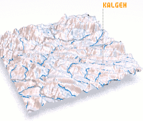 Places with similar names to Kalgeh, Iran ::
Disclaimer :: Information on this page comes without warranty of any kind |
||
|
Where is Kalgeh? Elevation and coordinates ::
Latitude (lat): 31°23'33"N Longitude (lon): 50°50'25"E
Elevation (approx.): 2084m (map arrows pan, magnifying glasses zoom) |
||
|
Visiting Kalgeh? Hotel/Accommodation ::
Book a hotel in Kalgeh Travel Guide ::
Buy a travel guide for Iran rental cars ::
car rental offers GPS waypoint ::
download a GPX waypoint (PoI) of Kalgeh for your GPS receiver
|
||