|
search place name
|
||
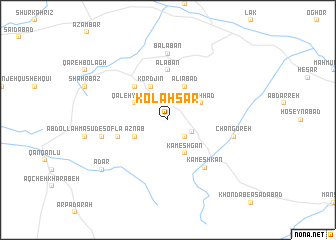
Kolah Sar (Iran)Kolah Sar is a town in Iran. An overview map of the region around Kolah Sar is displayed below.
regional and 3d topo map of Kolah Sar, Iran ::
Kolah Sar airports ::
The nearest airport is SDG - Sanandaj, located 181.6 km west of Kolah Sar.
Other airports nearby include RAS - Rasht (182.4 km north), RZR - Ramsar (202.8 km north east), KSH - Bakhtaran Shahid Ashrafi Esfahani (225.1 km south west), Nearby towns ::
Esmā‘īlābād (2.4km south east) //
Khvor Khvoreh (2.6km south east) //
Aznāb (3.5km south west) //
Qal‘eh-ye Dīdār (3.5km north west) //
Mashhad (3.5km north east) //
Kāmeshgān (4.0km south) //
‘Alīābād (4.0km north) //
Kordjīn (4.0km north) //
Dīdār (4.8km north west) //
Alābān (5.6km north) //
‘Abdollāh Mas‘ūd-e ‘Olyā (4.9km west) //
Kāmeshkān (6.3km south east) //
Bālābān (7.4km north) //
Lojāmgīr (6.3km west) //
Changūreh (6.3km east) //
Ādār (8.2km south west) //
[all distances 'as the bird flies' and approximate]  Places with similar names to Kolah Sar, Iran ::
// Kellassaare (EE)
// Këlcyrë (AL)
// Këlcyrë (AL)
// Klisare (BA)
// Klisura (BA)
// Klisura (BA)
// Klisura (BG)
// Căluşeri (RO)
// Kallioozero (RU)
// Kolesur (RU)
Disclaimer :: Information on this page comes without warranty of any kind |
||
|
Where is Kolah Sar? Elevation and coordinates ::
Latitude (lat): 35°47'0"N Longitude (lon): 48°54'0"E
Elevation (approx.): 2026m (map arrows pan, magnifying glasses zoom) |
||
|
Visiting Kolah Sar? Hotel/Accommodation ::
Book a hotel in Kolah Sar Travel Guide ::
Buy a travel guide for Iran rental cars ::
car rental offers GPS waypoint ::
download a GPX waypoint (PoI) of Kolah Sar for your GPS receiver
|
||