|
search place name
|
||
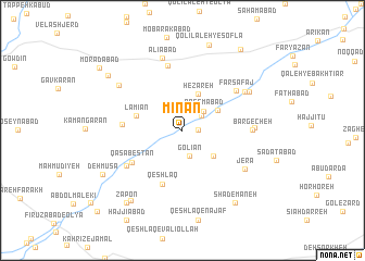
Mīnān (Hamadān, Iran)Mīnān is a town in the Hamadān region of Iran. An overview map of the region around Mīnān is displayed below.
regional and 3d topo map of Mīnān, Iran ::
Mīnān airports ::
The nearest airport is KSH - Bakhtaran Shahid Ashrafi Esfahani, located 99.7 km west of Mīnān.
Other airports nearby include SDG - Sanandaj (142.7 km north west), Nearby towns ::
Menjān (1.4km east) //
Akbarābād (2.2km north east) //
Golīān (2.7km south) //
Qāsemābād (2.6km north east) //
Hezāreh (4.0km north) //
Chāsht Khvoreh (3.6km north east) //
Barfīān (3.8km south east) //
Lāmīān (4.2km west) //
Qeshlāq (5.8km south) //
Qaşabestān (5.4km south west) //
Javādīyeh (5.2km west) //
Bāqerābād (6.7km north) //
Shabestān (6.0km south west) //
Farsafaj (6.2km north east) //
Bargecheh (6.0km east) //
Aḩmadābād (6.1km east) //
Jerā (6.6km south east) //
Farasfaj (6.6km north east) //
‘Alīābād (7.6km north) //
Amīrābād (6.9km north east) //
Qal‘eh Now (7.1km north west) //
Golīān (8.4km south west) //
Shādemāneh (8.6km south east) //
Qolī Lāleh-ye Sofla (9.1km north) //
Zāpon (8.8km south west) //
Deh Mūsá (8.2km south west) //
Ţardābād (8.4km north west) //
Karīmābād (9.6km north east) //
Morādābād (9.5km north west) //
[all distances 'as the bird flies' and approximate]  Places with similar names to Mīnān, Iran ::
Disclaimer :: Information on this page comes without warranty of any kind |
||
|
Where is Mīnān? Elevation and coordinates ::
Latitude (lat): 34°26'59"N Longitude (lon): 48°14'6"E
Elevation (approx.): 1572m (map arrows pan, magnifying glasses zoom) |
||
|
Visiting Mīnān? Hotel/Accommodation ::
Book a hotel in Mīnān Travel Guide ::
Buy a travel guide for Iran rental cars ::
car rental offers GPS waypoint ::
download a GPX waypoint (PoI) of Mīnān for your GPS receiver
|
||