|
search place name
|
||
Monādejān (Chahār Maḩāll va Bakhtīār, Iran)Monādejān is a town in the Chahār Maḩāll va Bakhtīār region of Iran. An overview map of the region around Monādejān is displayed below.
regional and 3d topo map of Monādejān, Iran ::

Monādejān airports ::
The nearest airport is QMJ - Masjed Soleiman Shahid Asyaee, located 193.0 km north west of Monādejān.
Other airports nearby include MRX - Bandar Mahshahr Mahshahr (204.5 km south west), SYZ - Shiraz Shahid Dastghaib Intl (238.9 km south east), Nearby towns ::
Bāgh-e Moḩammad ‘Alī (1.0km north west) //
Shūr Āb (1.5km south east) //
Qal‘eh Sūkhteh (2.3km north) //
Shahr-e Now (2.9km north) //
Dastgerd (3.1km south east) //
Shāh Najaf (3.5km north) //
Gand Āb (3.4km north east) //
Safīdār (4.0km east) //
Bīzh Gerd (5.8km east) //
Khar Poshteh (6.2km south east) //
Parvaz (6.8km south east) //
Dam Āb (6.5km south east) //
Sahlābād (6.4km east) //
Bāgh Kāj (7.8km south) //
Deh Chenār-e Dālvarād (7.8km north east) //
Deh-e Golābī (7.6km north east) //
Deh Kohneh (8.6km south) //
Kūh Rīg (8.0km south west) //
Mīnāb (7.8km east) //
Geysārān (9.1km south east) //
Fāj (10.9km south west) //
Ghāch (11.0km south west) //
[all distances 'as the bird flies' and approximate] 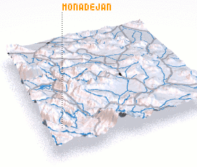 Places with similar names to Monādejān, Iran ::
// Mantauijan (PH)
// Montiejūnai (LT)
// Mandujano (MX)
// Mandujano (MX)
// Māndījān (IR)
// Mendejīn (IR)
// Monte Joana (CV)
// Mandjane (MZ)
// Montjean (FR)
// Muntadgin (AU)
Disclaimer :: Information on this page comes without warranty of any kind |
||
|
Where is Monādejān? Elevation and coordinates ::
Latitude (lat): 31°16'38"N Longitude (lon): 51°7'14"E
Elevation (approx.): 1975m (map arrows pan, magnifying glasses zoom) |
||
|
Visiting Monādejān? Hotel/Accommodation ::
Book a hotel in Monādejān Travel Guide ::
Buy a travel guide for Iran rental cars ::
car rental offers GPS waypoint ::
download a GPX waypoint (PoI) of Monādejān for your GPS receiver
|
||