|
search place name
|
||
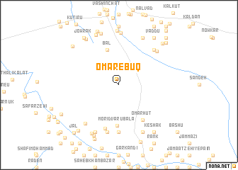
‘Omar-e Būq (Iran)‘Omar-e Būq is a town in Iran. An overview map of the region around ‘Omar-e Būq is displayed below.
regional and 3d topo map of ‘Omar-e Būq, Iran ::
‘Omar-e Būq airports ::
The nearest airport is ZBR - Chah Bahar, located 73.6 km south west of ‘Omar-e Būq.
Other airports nearby include GWD - Gwadar (139.4 km east), TRB - Turbo Turbat Intl (200.7 km east), Nearby towns ::
Bal (5.8km north) //
Morīdvārū Bālā (6.5km south) //
‘Omar Hūt (6.5km south east) //
Dīyūl (7.2km south) //
Seyyed Bārān (7.4km south) //
Morīdvārū Pā'īn (7.6km south) //
Ţārmā (7.5km north east) //
Mīnāb (7.6km north east) //
Jangārak (7.8km south west) //
Dīrmān (8.2km north) //
Mīnāb Zamīn (8.1km north east) //
Degrū (8.1km south west) //
Chīl Sar (8.1km south east) //
Talang (8.5km north) //
Shīr Moḩammad Bāzār (8.5km north) //
Shāhak Bāzār (8.5km north west) //
Rīg Sar (8.5km south west) //
Chorrak (8.6km north west) //
Lāynārī (8.8km south west) //
Lālū Bāzār (9.0km north) //
Jowrak (8.9km north west) //
Vaddū (8.9km north east) //
Keshāk (8.9km south east) //
Kārānī (9.2km south) //
Gaze'ī-ye Pā'īn (9.0km north west) //
Sattānī (9.1km north east) //
Bīlīngī (9.2km south west) //
Shūdīk (9.4km north east) //
Jal (9.9km south west) //
[all distances 'as the bird flies' and approximate] 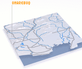 Places with similar names to ‘Omar-e Būq, Iran ::
// Ömerobaköy (TR)
Disclaimer :: Information on this page comes without warranty of any kind |
||
|
Where is ‘Omar-e Būq? Elevation and coordinates ::
Latitude (lat): 25°43'0"N Longitude (lon): 61°3'0"E
Elevation (approx.): 34m (map arrows pan, magnifying glasses zoom) |
||
|
Visiting ‘Omar-e Būq? Hotel/Accommodation ::
Book a hotel in ‘Omar-e Būq Travel Guide ::
Buy a travel guide for Iran rental cars ::
car rental offers GPS waypoint ::
download a GPX waypoint (PoI) of ‘Omar-e Būq for your GPS receiver
|
||