|
search place name
|
||
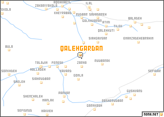
Qal‘eh Gardan (Iran)Qal‘eh Gardan is a town in Iran. An overview map of the region around Qal‘eh Gardan is displayed below.
regional and 3d topo map of Qal‘eh Gardan, Iran ::
Nearby towns ::
Zarmā (1.9km south) //
Emāmzādeh ‘Alī (2.4km north west) //
Band-e Bon (3.5km north) //
Sefīd Rūd (3.5km south west) //
Gomlā (4.8km south) //
Rūdbārak (4.0km east) //
Sīāh Gāvsar (4.8km north east) //
Kāvard (4.8km south west) //
Fenesk (4.9km west) //
Fīnesk (6.3km west) //
Qal‘eh Kūtī (7.1km north east) //
Gol Khvārān (8.0km north) //
Chahār Rūdbār (8.2km north) //
Ātīnī (8.7km north east) //
Parvar (9.3km south) //
Tīlek (9.4km north east) //
[all distances 'as the bird flies' and approximate] 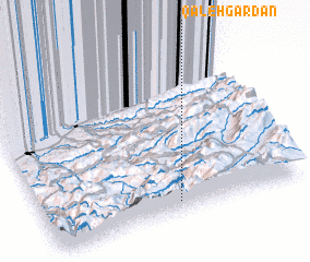 Places with similar names to Qal‘eh Gardan, Iran ::
// Kleegarten (DE)
// Qal‘eh Gardan (IR)
// Qal‘eh Gardan (IR)
// Killygordon (IE)
// Kullagården (SE)
// Kilcredan (IE)
Disclaimer :: Information on this page comes without warranty of any kind |
||
|
Where is Qal‘eh Gardan? Elevation and coordinates ::
Latitude (lat): 36°4'0"N Longitude (lon): 53°31'0"E
Elevation (approx.): 1498m (map arrows pan, magnifying glasses zoom) |
||
|
Visiting Qal‘eh Gardan? Hotel/Accommodation ::
Book a hotel in Qal‘eh Gardan Travel Guide ::
Buy a travel guide for Iran rental cars ::
car rental offers GPS waypoint ::
download a GPX waypoint (PoI) of Qal‘eh Gardan for your GPS receiver
|
||