|
search place name
|
||
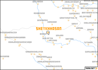
Sheykh Ḩasan (Ostān-e Kermānshāh, Iran)Sheykh Ḩasan is a town in the Ostān-e Kermānshāh region of Iran. An overview map of the region around Sheykh Ḩasan is displayed below.
regional and 3d topo map of Sheykh Ḩasan, Iran ::
Sheykh Ḩasan airports ::
The nearest airport is KSH - Bakhtaran Shahid Ashrafi Esfahani, located 88.4 km east of Sheykh Ḩasan.
Other airports nearby include SDG - Sanandaj (119.6 km north east), Nearby towns ::
Deh Lafteh (2.2km south) //
Bīāmeh (1.9km west) //
Dāleh Hū (3.2km south east) //
Rīsanī (4.0km south east) //
Kaneh Har (4.2km north) //
Deh-e Jāmī (3.6km east) //
Deh Jāmī (3.6km east) //
Deh Kohneh (5.1km north west) //
Choqā Mīrgeh (6.1km south east) //
Tanūreh (7.4km north) //
Veyleh-ye Yek (6.8km south east) //
Halāteh (8.0km south) //
Mīān Tang (8.0km south) //
Sartang (6.9km east) //
Āsīāb-e Mūsá (8.1km north) //
Shahrak-e Halateh (8.7km south west) //
Dasht-e Mūrt-e ‘Olyā (8.3km north east) //
Darreh Nījeh (8.3km north east) //
Sarmīl (9.2km south west) //
[all distances 'as the bird flies' and approximate] 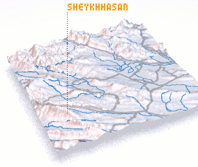 Places with similar names to Sheykh Ḩasan, Iran ::
// Chukson (US)
// Choczeń (PL)
// Chocznia (PL)
// Shixini (ZA)
// Shaykh Ḩusayn (IQ)
// Chāy Kasan (IR)
// Sheikh Hasan (ET)
// Chak Sonāi (BD)
// Chuaxán (GT)
// Chuaxán (GT)
Disclaimer :: Information on this page comes without warranty of any kind |
||
|
Where is Sheykh Ḩasan? Elevation and coordinates ::
Latitude (lat): 34°23'58"N Longitude (lon): 46°11'59"E
Elevation (approx.): 1654m (map arrows pan, magnifying glasses zoom) |
||
|
Visiting Sheykh Ḩasan? Hotel/Accommodation ::
Book a hotel in Sheykh Ḩasan Travel Guide ::
Buy a travel guide for Iran rental cars ::
car rental offers GPS waypoint ::
download a GPX waypoint (PoI) of Sheykh Ḩasan for your GPS receiver
|
||