|
search place name
|
||
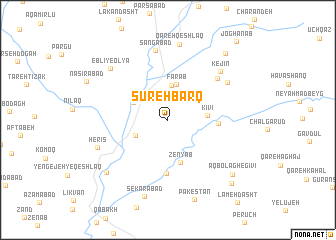
Sūreh Barq (Ardabīl, Iran)Sūreh Barq is a town in the Ardabīl region of Iran. An overview map of the region around Sūreh Barq is displayed below.
regional and 3d topo map of Sūreh Barq, Iran ::
Sūreh Barq airports ::
The nearest airport is RAS - Rasht, located 122.4 km east of Sūreh Barq.
Nearby towns ::
Harov (3.8km north) //
Seh Rāh-e Ganjgāh (3.3km south west) //
Fārāb (4.0km north) //
Ganjgāh (3.7km north west) //
Kīvī (3.6km east) //
Zenyāb (4.8km south) //
Kīvī-ye Pā'īn (4.5km east) //
Sa‘īdābād (6.0km south) //
Sūtehzār (6.4km north east) //
‘Alīābād (6.7km north east) //
Sangābād (7.8km north) //
Kejīn (7.1km north east) //
Herīs (7.0km south west) //
Qareh Qeshlāq (8.5km north) //
Eblī-ye Soflá (7.7km north west) //
Eblī-ye ‘Olyā (7.7km north west) //
Sekarābād (8.8km south) //
Īlkhchī (8.0km south west) //
Pākestān (9.2km south) //
Āqbolāgh-e Gīvī (8.3km south east) //
Shūyer (9.0km north east) //
Behestān (9.0km south east) //
Joghanāb (10.7km north east) //
[all distances 'as the bird flies' and approximate] 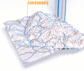 Places with similar names to Sūreh Barq, Iran ::
// Zaraberg (AT)
// Saarburg (DE)
// Surburg (DE)
// Suurbraak (ZA)
// Zera Biruk (ET)
// Saré Barka (SN)
// Sūreh Barq (IR)
// Surberg (DE)
// Sarrebourg (FR)
// Surbourg (FR)
Disclaimer :: Information on this page comes without warranty of any kind |
||
|
Where is Sūreh Barq? Elevation and coordinates ::
Latitude (lat): 37°40'56"N Longitude (lon): 48°17'46"E
Elevation (approx.): 1347m (map arrows pan, magnifying glasses zoom) |
||
|
Visiting Sūreh Barq? Hotel/Accommodation ::
Book a hotel in Sūreh Barq Travel Guide ::
Buy a travel guide for Iran rental cars ::
car rental offers GPS waypoint ::
download a GPX waypoint (PoI) of Sūreh Barq for your GPS receiver
|
||