|
search place name
|
||
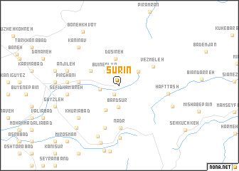
Sūrīn (Kordestān, Iran)Sūrīn is a town in the Kordestān region of Iran. An overview map of the region around Sūrīn is displayed below.
regional and 3d topo map of Sūrīn, Iran ::
Sūrīn airports ::
The nearest airport is SDG - Sanandaj, located 117.2 km south east of Sūrīn.
Other airports nearby include KSH - Bakhtaran Shahid Ashrafi Esfahani (204.6 km south east), Nearby towns ::
Marqad-e Sūrīn (1.5km south west) //
Bū'īn-e ‘Olyā (2.8km north west) //
Havāreh Khūl (2.6km west) //
Bardsūr (3.5km south) //
Kūyreh Kūyz (3.3km north east) //
Dūsīneh (4.2km north) //
Qūlaster (4.2km south west) //
Bezhī (4.3km north west) //
Vezmeleh (5.2km north east) //
Gīvaleh (5.2km west) //
Nadr (6.6km south) //
Mīrgolāb (6.9km south) //
Haft Tāsh (6.4km east) //
Berūshkānī (8.2km south) //
Khūrīābād (7.3km south west) //
Pīr Ghanī (6.7km west) //
Sefīd Kamareh (6.8km west) //
Anjīleh (7.1km west) //
Shasheh (8.4km south) //
Kānī Nāv (7.9km north west) //
Mīshāb-e Bālā (7.5km south east) //
‘Abbāsābād (8.6km south west) //
Boneh Khvoy (9.6km north west) //
Mīr ‘Os̄mān (11.1km south west) //
[all distances 'as the bird flies' and approximate] 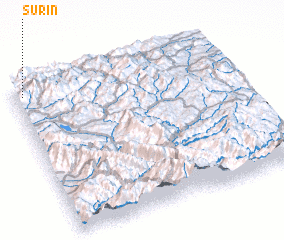 Places with similar names to Sūrīn, Iran ::
Disclaimer :: Information on this page comes without warranty of any kind |
||
|
Where is Sūrīn? Elevation and coordinates ::
Latitude (lat): 35°56'45"N Longitude (lon): 46°2'27"E
Elevation (approx.): 1675m (map arrows pan, magnifying glasses zoom) |
||
|
Visiting Sūrīn? Hotel/Accommodation ::
Book a hotel in Sūrīn Travel Guide ::
Buy a travel guide for Iran rental cars ::
car rental offers GPS waypoint ::
download a GPX waypoint (PoI) of Sūrīn for your GPS receiver
|
||