|
search place name
|
||
Sūzan (Hamadān, Iran)Sūzan is a town in the Hamadān region of Iran. An overview map of the region around Sūzan is displayed below.
regional and 3d topo map of Sūzan, Iran ::

Sūzan airports ::
The nearest airport is RZR - Ramsar, located 226.2 km north east of Sūzan.
Nearby towns ::
Shanjūr (2.3km north) //
Mesīnak (2.4km south west) //
Shāhanjarīn (3.3km north east) //
Tamūzān (3.5km west) //
Vasmaq (4.3km north) //
Zehtarān (3.7km west) //
Malīlak (3.7km west) //
Vālāshejerd (4.6km north west) //
Kāj (4.1km north west) //
Jāvar Sajīn (4.2km east) //
Pīleh Kān (4.7km north east) //
Ḩesāmābād (5.5km south) //
Pīr Bak (5.0km west) //
Salīlak (5.9km south west) //
Bāghcheh Ghāz (7.0km south) //
Qorveh (6.0km north west) //
Rāzīn (6.9km north west) //
Kamandān (6.9km north west) //
Dehlaq (7.1km south west) //
Boḩkandān (6.6km west) //
Aḩmadābād (7.8km north west) //
‘Ommān (7.8km north west) //
Rakīn (7.2km south west) //
Qābānqolī (8.9km south) //
Dowlūjerdīn-e Bālā (9.3km north west) //
Dowlūjerdīn-e Pā'īn (9.3km north west) //
Shūrgol (8.8km south east) //
Shahrak-e Darjazīn (9.7km north east) //
Darjazīn (10.6km north west) //
[all distances 'as the bird flies' and approximate] 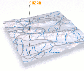 Places with similar names to Sūzan, Iran ::
Disclaimer :: Information on this page comes without warranty of any kind |
||
|
Where is Sūzan? Elevation and coordinates ::
Latitude (lat): 35°16'46"N Longitude (lon): 49°10'16"E
Elevation (approx.): 1803m (map arrows pan, magnifying glasses zoom) |
||
|
Visiting Sūzan? Hotel/Accommodation ::
Book a hotel in Sūzan Travel Guide ::
Buy a travel guide for Iran rental cars ::
car rental offers GPS waypoint ::
download a GPX waypoint (PoI) of Sūzan for your GPS receiver
|
||