|
search place name
|
||
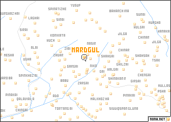
Mard Gul (Balochistān, Pakistan)Mard Gul is a town in the Balochistān region of Pakistan. An overview map of the region around Mard Gul is displayed below.
regional and 3d topo map of Mard Gul, Pakistan ::
Mard Gul airports ::
The nearest airport is UET - Quetta, located 84.7 km south west of Mard Gul.
Other airports nearby include KDH - Kandahar (162.3 km north west), Nearby towns ::
Potai (1.1km north east) //
Ghāzi Nau (1.4km north) //
Abdakai Bostān (1.9km south) //
Kachai (2.2km south) //
Gulwandai (2.7km south) //
Niko (2.7km south east) //
Nāsir (3.0km north east) //
Tangi (2.8km north east) //
Abkakai Daūd (3.2km south) //
Gargai (3.2km south west) //
Ziāba (3.4km north west) //
Ghunzagai (3.9km south west) //
Aghbargai (3.8km east) //
Ghez (3.9km west) //
Shāhai (4.6km south east) //
Rāgha (4.1km west) //
Gai (4.7km south east) //
Shāhgai (4.4km east) //
Nau (4.7km south east) //
Gurk (5.0km south west) //
Zadar (4.9km west) //
Tor (5.1km east) //
Obo Saiyid (5.2km north west) //
Zargai (6.0km south) //
Tikhai (5.8km south east) //
Kwat (5.6km south west) //
Walgai (6.0km south east) //
Walgai (6.1km south east) //
Zakaria (6.2km north east) //
[all distances 'as the bird flies' and approximate] 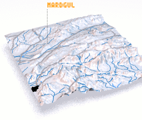 Places with similar names to Mard Gul, Pakistan ::
// Muritgale (MM)
// Mertekli (TR)
// Mertekli (TR)
// Muratçalı (TR)
// Muratkolu (TR)
// Morād Qolī (IR)
// Morād Qolī (IR)
// Martyk-Kulʼ (KZ)
// Mard Kalā (AF)
// Martikkala (FI)
Disclaimer :: Information on this page comes without warranty of any kind |
||
|
Where is Mard Gul? Elevation and coordinates ::
Latitude (lat): 30°54'10"N Longitude (lon): 67°24'0"E
Elevation (approx.): 2153m (map arrows pan, magnifying glasses zoom) |
||
|
Visiting Mard Gul? Hotel/Accommodation ::
Book a hotel in Mard Gul Travel Guide ::
Buy a travel guide for Pakistan rental cars ::
car rental offers GPS waypoint ::
download a GPX waypoint (PoI) of Mard Gul for your GPS receiver
|
||