|
search place name
|
||
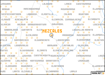
Mezcales (Francisco Morazán, Honduras)Mezcales is a town in the Francisco Morazán region of Honduras. An overview map of the region around Mezcales is displayed below.
regional and 3d topo map of Mezcales, Honduras ::
Mezcales airports ::
The nearest airport is TGU - Tegucigalpa Toncontin Intl, located 22.7 km north of Mezcales.
Other airports nearby include SAP - San Pedro Sula La Mesa Intl (194.3 km north west), LCE - La Ceiba Goloson Intl (210.0 km north), SAL - San Salvador El Salvador Intl (211.5 km west), TEA - Tela (214.1 km north), Nearby towns ::
Barajana (3.7km south) //
El Ciruelo (4.0km north west) //
Los Mezcales (4.0km north west) //
El Guanacaste (4.0km south west) //
Guajiniquil (4.1km north east) //
Terrero Blanco (4.0km south east) //
Los Rincones (4.0km south east) //
Salalica (4.1km south east) //
La Uvilla (5.2km south east) //
Paso Ganado (5.2km south east) //
La Ciénaga (5.4km west) //
Paso Hondo (5.4km east) //
El Rincón (5.8km south) //
El Carrizal (5.8km north) //
Las Trancas (5.8km north) //
Rodeo Grande (5.7km east) //
El Zapote (6.6km south west) //
La Montaña de Izopo (6.5km north west) //
San Buenaventura (6.5km north west) //
Terreritos (6.6km south east) //
Cerro Colorado (6.6km south east) //
Las Tablas (6.5km south east) //
Las Casitas (7.4km north) //
Yocuma (7.4km north) //
El Terrero (7.2km west) //
Guayapito (7.2km west) //
El Calvario (7.2km west) //
El Peñón (7.2km west) //
Los Noques (7.2km west) //
[all distances 'as the bird flies' and approximate] 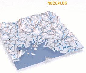 Places with similar names to Mezcales, Honduras ::
Disclaimer :: Information on this page comes without warranty of any kind |
||
|
Where is Mezcales? Elevation and coordinates ::
Latitude (lat): 13°52'0"N Longitude (lon): 87°9'0"W
Elevation (approx.): 1235m (map arrows pan, magnifying glasses zoom) |
||
|
Visiting Mezcales? Hotel/Accommodation ::
Book a hotel in Mezcales Travel Guide ::
Buy a travel guide for Honduras rental cars ::
car rental offers GPS waypoint ::
download a GPX waypoint (PoI) of Mezcales for your GPS receiver
|
||