|
search place name
|
||
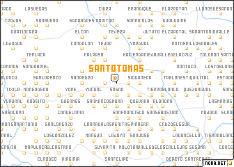
Santo Tomás (Lempira, Honduras)Santo Tomás is a town in the Lempira region of Honduras. An overview map of the region around Santo Tomás is displayed below.
regional and 3d topo map of Santo Tomás, Honduras ::
Santo Tomás airports ::
The nearest airport is SAL - San Salvador El Salvador Intl, located 97.4 km south west of Santo Tomás.
Other airports nearby include TGU - Tegucigalpa Toncontin Intl (138.8 km east), SAP - San Pedro Sula La Mesa Intl (158.6 km north east), TEA - Tela (212.5 km north east), LCE - La Ceiba Goloson Intl (251.2 km north east), Nearby towns ::
Sosna (1.9km south) //
El Potrero (1.9km south) //
Cauquín (1.9km north) //
Guatismón (1.8km west) //
Palmar (1.8km west) //
Malura (1.8km east) //
Corta Cabezas (1.8km east) //
Los Planes (1.8km west) //
Paraíso (2.6km south east) //
Cojuanque (2.6km south east) //
Cacagual (2.6km south east) //
Esquimpara (2.6km north west) //
Copantillo (3.6km east) //
Siguanera (3.6km east) //
Buena Vista (3.6km east) //
El Águila (3.7km south) //
Yucual (4.0km south west) //
Sompopo (4.0km south west) //
San José (4.0km south east) //
Santa Rosa (4.0km south west) //
Los Raimundos (4.1km south east) //
El Malincote (4.1km south east) //
San Marcos Mora (4.1km south west) //
Mavita (4.1km south east) //
San José (4.1km south east) //
Guatincara (4.1km north west) //
Pabo (5.2km south west) //
Quevara (5.2km south east) //
Los Guardados (5.2km south west) //
[all distances 'as the bird flies' and approximate] 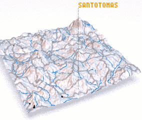 Places with similar names to Santo Tomás, Honduras ::
// Santo Tomas (US)
// Santo Tomás (PA)
// Santo Tomás (CU)
// Santo Tomás (CU)
// Santo Tomás (CU)
// Santo Tomás (CU)
// Santo Tomás (CU)
// Santo Tomás (CU)
// Santo Tomás (CU)
// Santo Tomás (CU)
Disclaimer :: Information on this page comes without warranty of any kind |
||
|
Where is Santo Tomás? Elevation and coordinates ::
Latitude (lat): 14°8'0"N Longitude (lon): 88°30'0"W
Elevation (approx.): 1576m (map arrows pan, magnifying glasses zoom) |
||
|
Visiting Santo Tomás? Hotel/Accommodation ::
Book a hotel in Santo Tomás Travel Guide ::
Buy a travel guide for Honduras rental cars ::
car rental offers GPS waypoint ::
download a GPX waypoint (PoI) of Santo Tomás for your GPS receiver
|
||