|
search place name
|
||
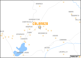
Calanaza (Tacna, Peru)Calanaza is a town in the Tacna region of Peru. An overview map of the region around Calanaza is displayed below.
regional and 3d topo map of Calanaza, Peru ::
Calanaza airports ::
The nearest airport is TCQ - Tacna Coronel Carlos Ciriani Santa Rosa Intl, located 94.2 km south west of Calanaza.
Other airports nearby include ARI - Arica Chacalluta (121.1 km south west), LPB - La Paz El Alto Intl (185.3 km north east), Nearby towns ::
El Porvenir (1.9km north east) //
Viluyo (2.5km east) //
Rosas Pata (2.5km west) //
Ancomarca (3.2km south) //
Ticuta (3.5km east) //
Huma Huaycho (4.2km north west) //
Calvarioni (4.8km east) //
Hospicio (4.9km west) //
Chapi (5.4km south west) //
Chontacollo (5.9km west) //
Mocomoconi (7.2km west) //
Visviri (7.9km south east) //
Piyuta (8.8km south west) //
Churuyo (9.0km south west) //
Ancuyo (9.1km south west) //
[all distances 'as the bird flies' and approximate]  Places with similar names to Calanaza, Peru ::
Disclaimer :: Information on this page comes without warranty of any kind |
||
|
Where is Calanaza? Elevation and coordinates ::
Latitude (lat): 17°32'43"S Longitude (lon): 69°33'46"W
Elevation (approx.): 4178m (map arrows pan, magnifying glasses zoom) |
||
|
Visiting Calanaza? Hotel/Accommodation ::
Book a hotel in Calanaza Travel Guide ::
Buy a travel guide for Peru rental cars ::
car rental offers GPS waypoint ::
download a GPX waypoint (PoI) of Calanaza for your GPS receiver
|
||