|
search place name
|
||
Llactaviri (Cusco, Peru)Llactaviri is a town in the Cusco region of Peru. An overview map of the region around Llactaviri is displayed below.
regional and 3d topo map of Llactaviri, Peru ::

Llactaviri airports ::
The nearest airport is CUZ - Cuzco Teniente Alejandro Velasco Astete Intl, located 115.1 km north west of Llactaviri.
Other airports nearby include JUL - Juliaca (172.2 km south east), Nearby towns ::
Churulla (1.0km north west) //
Herca (1.0km north) //
Chillapata (1.3km north east) //
Chillacruz (1.8km north east) //
Llacuyochupa (2.1km west) //
Laripucho (2.5km east) //
Huancarani (3.0km north east) //
Antaparera (2.9km south east) //
Mojón Suyo (3.3km north) //
Colo (3.4km south west) //
Caracoto (3.6km south east) //
Ccercapunco (3.6km north east) //
Huahuañuma (3.6km west) //
Senccachectuyoc (3.7km east) //
Suyo (4.0km north west) //
Trapiche (4.3km north east) //
Lizani (4.3km south west) //
Acota (4.4km north) //
Chacapata (4.3km east) //
Chuma Qocha Pampa (5.0km north) //
Oquechupa (4.9km east) //
Taruca (5.0km north east) //
Chaucnapata (5.0km east) //
Sullca (5.3km south east) //
Huitaca (5.7km north east) //
Manuel Prado (5.9km north) //
Chactuyoc (5.7km east) //
Sicuani (6.1km north) //
Ocoruro (6.0km south east) //
[all distances 'as the bird flies' and approximate] 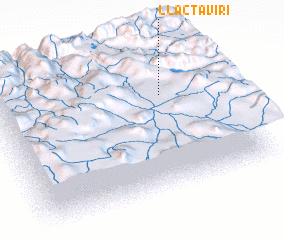 Places with similar names to Llactaviri, Peru ::
// Lekhto-Vaara (RU)
// Lekhtovaara (RU)
// Llactovire (PE)
// La Godefroy (FR)
// Lagoa de Fora (BR)
Disclaimer :: Information on this page comes without warranty of any kind |
||
|
Where is Llactaviri? Elevation and coordinates ::
Latitude (lat): 14°19'19"S Longitude (lon): 71°14'29"W
Elevation (approx.): 3685m (map arrows pan, magnifying glasses zoom) |
||
|
Visiting Llactaviri? Hotel/Accommodation ::
Book a hotel in Llactaviri Travel Guide ::
Buy a travel guide for Peru rental cars ::
car rental offers GPS waypoint ::
download a GPX waypoint (PoI) of Llactaviri for your GPS receiver
|
||