|
search place name
|
||
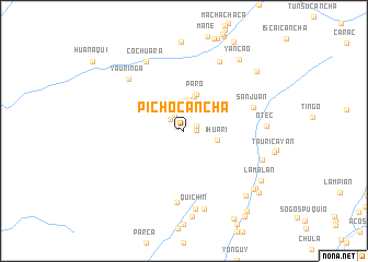
Pichocancha (Lima, Peru)Pichocancha is a town in the Lima region of Peru. An overview map of the region around Pichocancha is displayed below.
regional and 3d topo map of Pichocancha, Peru ::
Pichocancha airports ::
The nearest airport is LIM - Lima Jorge Chavez Intl, located 94.2 km south of Pichocancha.
Other airports nearby include ATA - Anta Comandante Fap German Arias Graziani (213.7 km north), Nearby towns ::
Chohuitama (0.8km north west) //
Cullpa (1.2km east) //
Tan Tan (1.4km east) //
Huaycho (1.8km north west) //
Huaquilla (1.8km north west) //
Quellpampa (1.9km north) //
Yuncan (2.1km north) //
Ramparaca (2.4km north) //
Chau Pirarca (2.9km north) //
Huaylinco (3.1km north) //
Huaicho Viejo (3.3km north) //
Ihuari (3.5km east) //
Oliquin (3.6km north) //
Paro (4.0km north) //
Palca (7.4km south) //
San Juan (7.4km east) //
Yauringa (7.6km north west) //
Chaura (7.9km north east) //
Cochuara (8.0km north west) //
Quichin (8.1km south) //
Auchi (8.2km south) //
Cochec (8.3km east) //
Otec (8.3km east) //
Marin (8.8km south) //
Naupay (9.1km south east) //
Yancao (9.1km north east) //
Maran Pampa (9.1km south east) //
Lamblan (9.3km south east) //
Cachoalin (9.3km south east) //
[all distances 'as the bird flies' and approximate] 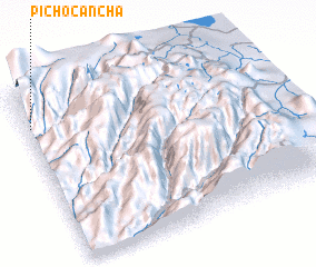 Places with similar names to Pichocancha, Peru ::
// Pichacancha (PE)
Disclaimer :: Information on this page comes without warranty of any kind |
||
|
Where is Pichocancha? Elevation and coordinates ::
Latitude (lat): 11°10'50"S Longitude (lon): 76°58'57"W
Elevation (approx.): 2318m (map arrows pan, magnifying glasses zoom) |
||
|
Visiting Pichocancha? Hotel/Accommodation ::
Book a hotel in Pichocancha Travel Guide ::
Buy a travel guide for Peru rental cars ::
car rental offers GPS waypoint ::
download a GPX waypoint (PoI) of Pichocancha for your GPS receiver
|
||