|
search place name
|
||
El Borracho (Anzoátegui, Venezuela)El Borracho is a town in the Anzoátegui region of Venezuela. An overview map of the region around El Borracho is displayed below.
regional and 3d topo map of El Borracho, Venezuela ::

El Borracho airports ::
The nearest airport is SOM - San Tome, located 100.6 km north east of El Borracho.
Other airports nearby include CBL - Ciudad Bolivar (110.4 km east), AAO - Anaco (145.0 km north), PZO - Guayana General Manuel Carlos Piar (196.8 km east), VDP - Valle De La Pascua (201.1 km north west), Nearby towns ::
Bebedero (4.2km south west) //
Las Brisas (4.5km south) //
Zanjonalito (4.7km south) //
El Bolsillo (5.7km south) //
Limoncito (6.6km north) //
El Alto (6.8km south) //
San Luis (6.8km north east) //
Juancho López (7.0km south west) //
Domingote (7.3km west) //
Mahomito (8.4km south east) //
Yugoeslavia (9.5km north east) //
Picachón (9.8km north west) //
El Picacho (11.0km north east) //
La Orilla (11.3km south east) //
[all distances 'as the bird flies' and approximate] 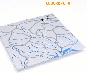 Places with similar names to El Borracho, Venezuela ::
// El Briche (CU)
// El Barciao (CO)
// El Borracho (CO)
// El Borracho (MX)
// El Bruch (ES)
// El Brocho (CO)
// El Bracho (AR)
// El Borach (BR)
Disclaimer :: Information on this page comes without warranty of any kind |
||
|
Where is El Borracho? Elevation and coordinates ::
Latitude (lat): 8°7'16"N Longitude (lon): 64°32'20"W
Elevation (approx.): 93m (map arrows pan, magnifying glasses zoom) |
||
|
Visiting El Borracho? Hotel/Accommodation ::
Book a hotel in El Borracho Travel Guide ::
Buy a travel guide for Venezuela rental cars ::
car rental offers GPS waypoint ::
download a GPX waypoint (PoI) of El Borracho for your GPS receiver
|
||