|
search place name
|
||
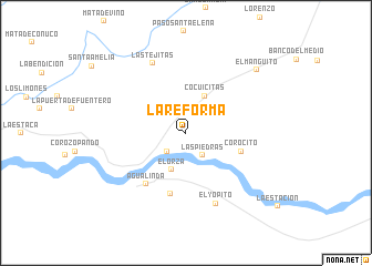
La Reforma (Apure, Venezuela)La Reforma is a town in the Apure region of Venezuela. An overview map of the region around La Reforma is displayed below.
regional and 3d topo map of La Reforma, Venezuela ::
La Reforma airports ::
The nearest airport is AUC - Arauca Santiago Perez, located 138.5 km west of La Reforma.
Other airports nearby include BNS - Barinas (186.7 km north west), GUQ - Guanare (215.2 km north), PCR - Puerto Carreno (242.2 km south east), MRD - Merida Alberto Carnevalli (247.2 km north west), Nearby towns ::
Las Delicias (2.6km south west) //
Las Piedras (2.9km south east) //
Elorza (4.0km south) //
Cocuicitas (4.1km north east) //
Corocito (5.8km east) //
Las Manzanitas (6.3km south) //
Agua Linda (6.5km south west) //
El Yopito (7.7km south east) //
Las Tejitas (7.7km north west) //
El Manguito (9.6km north east) //
[all distances 'as the bird flies' and approximate] 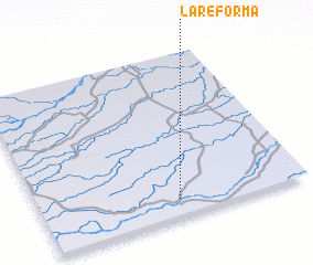 Places with similar names to La Reforma, Venezuela ::
// La Reforma (CU)
// La Reforma (CU)
// La Reforma (CU)
// La Reforma (CU)
// La Reforma (US)
// La Reforma (CO)
// La Reforma (CO)
// La Reforma (CO)
// La Reforma (CO)
// La Reforma (CO)
Disclaimer :: Information on this page comes without warranty of any kind |
||
|
Where is La Reforma? Elevation and coordinates ::
Latitude (lat): 7°6'0"N Longitude (lon): 69°29'0"W
Elevation (approx.): 90m (map arrows pan, magnifying glasses zoom) |
||
|
Visiting La Reforma? Hotel/Accommodation ::
Book a hotel in La Reforma Travel Guide ::
Buy a travel guide for Venezuela rental cars ::
car rental offers GPS waypoint ::
download a GPX waypoint (PoI) of La Reforma for your GPS receiver
|
||