|
search place name
|
||
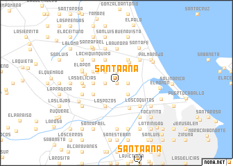
Santa Ana (Zulia, Venezuela)Santa Ana is a town in the Zulia region of Venezuela. An overview map of the region around Santa Ana is displayed below.
regional and 3d topo map of Santa Ana, Venezuela ::
Santa Ana airports ::
The nearest airport is MAR - Maracaibo La Chinita Intl, located 23.1 km south of Santa Ana.
Other airports nearby include RCH - Rio Hacha Almirante Padilla (155.0 km north west), VUP - Valledupar Alfonso Lopez Pumarejo (169.9 km west), STB - Santa Barbara Del Zulia (199.6 km south), VLV - Valera Dr Antonio Nicolas Briceno (201.9 km south east), Nearby towns ::
Santa Lucía (0.0km north) //
El Félix (1.8km east) //
Andrés (1.9km north) //
La Cruz (1.8km west) //
San Marcos (2.6km south east) //
Belén (2.6km north west) //
San Antonio (3.6km north west) //
Escondido (3.6km west) //
Monte Verde (3.9km north east) //
El Carmelo (4.1km north east) //
Bella Vista (4.1km north east) //
El Auxilio (4.1km north west) //
Bicicleta (4.1km north west) //
Los Pozos (4.1km south west) //
El Emboscado (4.1km south west) //
Iragorry (4.6km south east) //
Las Mandocas (5.2km north east) //
Los Coquitos (5.2km south east) //
La Chiquinquira (5.2km north west) //
El Paraíso (5.2km north west) //
Concepción (5.2km north west) //
Las Cuatro Bocas (5.2km west) //
La Piedra (5.2km west) //
Las Delicias (5.5km west) //
La Aurora (5.6km north) //
La Victoria (5.6km north) //
Aceituno (5.8km west) //
Las Tucacas (5.8km west) //
San Juan (5.8km west) //
[all distances 'as the bird flies' and approximate]  Places with similar names to Santa Ana, Venezuela ::
Disclaimer :: Information on this page comes without warranty of any kind |
||
|
Where is Santa Ana? Elevation and coordinates ::
Latitude (lat): 10°46'0"N Longitude (lon): 71°44'0"W
Elevation (approx.): 34m (map arrows pan, magnifying glasses zoom) |
||
|
Visiting Santa Ana? Hotel/Accommodation ::
Book a hotel in Santa Ana Travel Guide ::
Buy a travel guide for Venezuela rental cars ::
car rental offers GPS waypoint ::
download a GPX waypoint (PoI) of Santa Ana for your GPS receiver
|
||