|
search place name
|
||
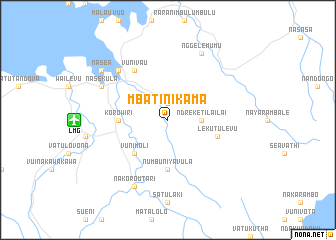
Mbatinikama (Fiji)Mbatinikama is a town in Fiji. An overview map of the region around Mbatinikama is displayed below.
regional and 3d topo map of Mbatinikama, Fiji ::
Mbatinikama airports ::
The nearest airport is LMG - Lambasa Labasa, located 10.0 km west of Mbatinikama.
Other airports nearby include SUV - Nausori Intl (197.7 km south west), NAN - Nandi Nadi Intl (255.3 km south west), Nearby towns ::
Namoli (1.9km north) //
Mbulileka (1.9km north) //
Ndreketilailai (3.6km east) //
Vunimoli (5.1km south west) //
Korowiri (5.3km west) //
Numbuniyavula (5.6km south) //
Lekutulevu (5.6km east) //
Vunivau (6.6km north west) //
Lambasa (7.7km north west) //
Nakoroutari (8.2km south west) //
Nasekula (8.0km north west) //
Nggelemumu (8.2km north east) //
Nasea (9.0km north west) //
[all distances 'as the bird flies' and approximate] 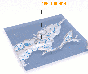 Places with similar names to Mbatinikama, Fiji ::
// Mietenkam (DE)
// Matongama (LK)
// Mudunnegama (LK)
// Mudunnegama (LK)
// Mutangama (ZM)
// Medenguma (MZ)
// Modenkema (SL)
Disclaimer :: Information on this page comes without warranty of any kind |
||
|
Where is Mbatinikama? Elevation and coordinates ::
Latitude (lat): 16°28'0"S Longitude (lon): 179°26'0"E
Elevation (approx.): 173m (map arrows pan, magnifying glasses zoom) |
||
|
Visiting Mbatinikama? Hotel/Accommodation ::
Book a hotel in Mbatinikama Travel Guide ::
Buy a travel guide for Fiji rental cars ::
car rental offers GPS waypoint ::
download a GPX waypoint (PoI) of Mbatinikama for your GPS receiver
|
||