|
search place name
|
||
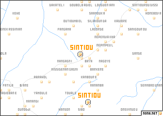
Sintiou (Koundara, Guinea)Sintiou is a town in the Koundara region of Guinea. An overview map of the region around Sintiou is displayed below.
regional and 3d topo map of Sintiou, Guinea ::
Sintiou airports ::
The nearest airport is KGG - Kedougou, located 47.1 km north east of Sintiou.
Other airports nearby include LEK - Labe (120.1 km south), TUD - Tambacounda (189.8 km north west), Nearby towns ::
Sintiou Bidéfélo (0.0km north) //
Lessaré (1.9km north) //
Sintiou Bohéré (1.8km east) //
Koubia (1.9km south) //
Baya (2.6km south east) //
Bokar Diakanké (4.1km north east) //
Nangagni (4.1km south west) //
Barkéré (5.2km south east) //
Missidé Nangagni (5.2km south west) //
Népin Peul (5.7km east) //
Kanbouré (5.8km south) //
Dakadounbanbé (5.8km south) //
Nagoye (5.7km east) //
Népen Diakha (6.6km north east) //
Lagordé (6.6km north east) //
Fangama (6.6km north west) //
Outioumbel (7.6km north) //
Sila Kounda (8.2km north east) //
Mananba (8.3km south east) //
Komafélé (8.1km north east) //
Nangagni (9.1km south west) //
[all distances 'as the bird flies' and approximate] 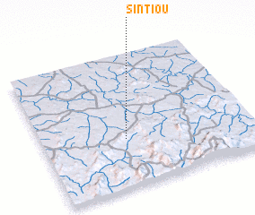 Places with similar names to Sintiou, Guinea ::
Disclaimer :: Information on this page comes without warranty of any kind |
||
|
Where is Sintiou? Elevation and coordinates ::
Latitude (lat): 12°22'0"N Longitude (lon): 12°36'0"W
Elevation (approx.): 144m (map arrows pan, magnifying glasses zoom) |
||
|
Visiting Sintiou? Hotel/Accommodation ::
Book a hotel in Sintiou Travel Guide ::
Buy a travel guide for Guinea rental cars ::
car rental offers GPS waypoint ::
download a GPX waypoint (PoI) of Sintiou for your GPS receiver
|
||